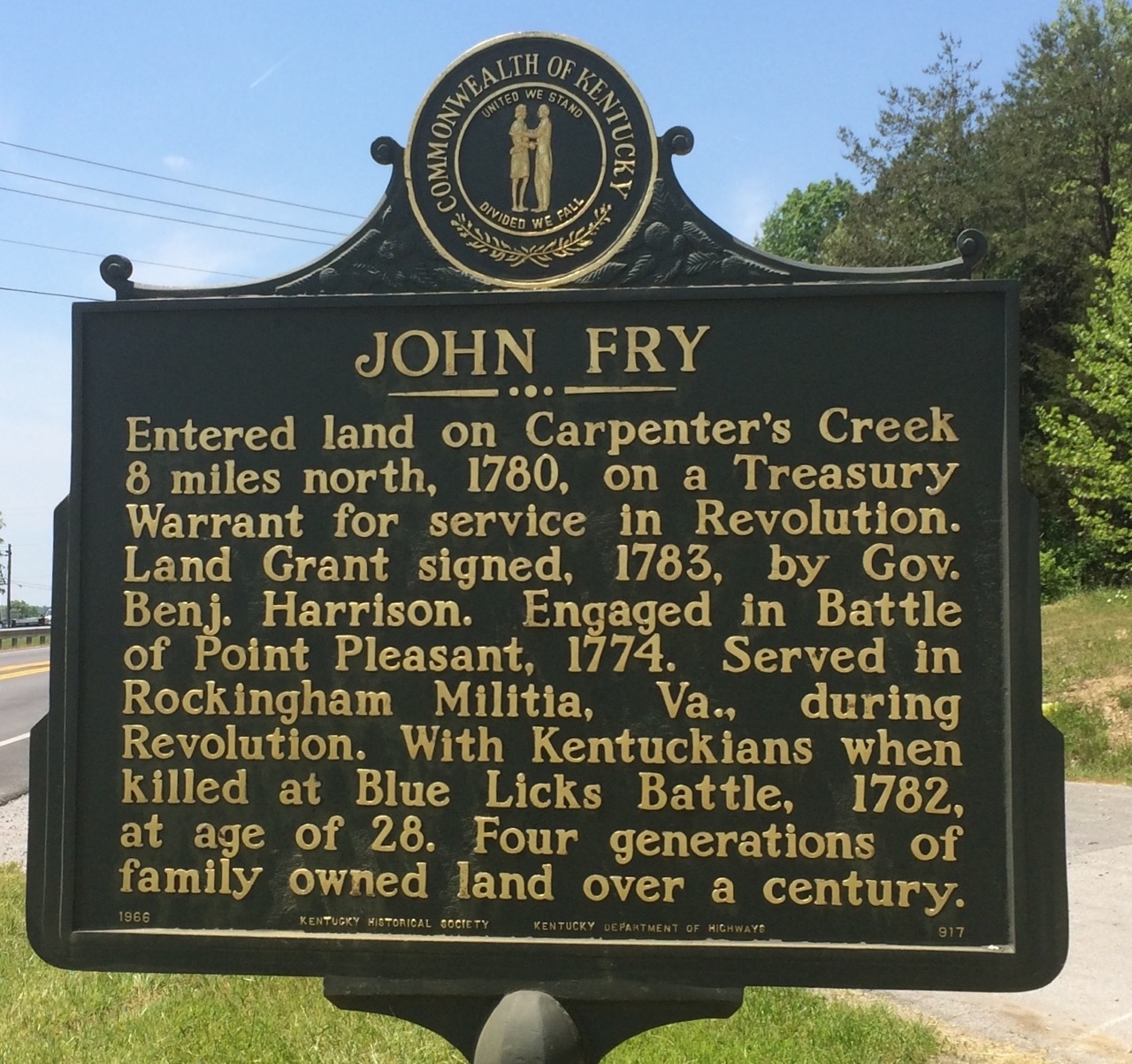
Marker #917 John Fry
Marker #917 sits near the intersection of N. Wallace Wilkinson Boulevard and Leonard Wilkinson Way. The marker is across the road from the three-way intersection in a grass area near a public parking area. The parking is as across from the intersection.
Text
Historical Marker #917, “John Fry” in Casey County, Kentucky, references John Fry (or Frye), a veteran of Lord Dunmore’s War and the Revolutionary War.
Fry is listed as a private in the September 1774 volunteer rolls of Captain William Nalls’ company from Augusta, Virginia, in Lord Dunmore’s War. This conflict began when Virginia Governor John Murray, fourth Earl of Dunmore, declared war on the Shawnee and Mingo tribes of the trans-Appalachian region. The war ended at the Battle of Point Pleasant in Virginia. It resulted in the establishment of a boundary between the Shawnee and Mingo tribes and the Virginia colonists at the Ohio River and the establishment of Kentucky as a county of Virginia. Fry was given land in Kentucky as part of his service in the war.
After Dunmore’s War, Fry was granted about 400 acres on Carpenter’s Creek in Lincoln County, one of the three counties in Kentucky before statehood.
Fry’s year of birth is currently unknown, but it is speculated he was born in either 1753 or 1754. According to findagrave.com, he was killed at the age of 27 or 28. The date of his death and location is confirmed by Bennett H. Young’s History of the Battle of Blue Licks in a roster of those killed on August 19, 1782, during the Battle of Blue Licks. Fry served under the command of Colonel Daniel Boone during the battle. The Battle of Blue Licks, to many Kentuckians, was the last battle of the American Revolution. Although the battle was a military disaster for the Kentucky militia, the outcome had no effect on the revolution. The British had already surrendered the war at Yorktown. However, this battle created greater tensions between Kentuckians and the Native Americans that would continue into the War of 1812. Fry was buried by his comrades on the Blue Licks battlefield.
After Fry’s death, his wife, Catherine Spears, remarried Adam Carpenter, who lived in the Carpenter’s Creek area of what is now Casey County. Catherine and the Carpenter family lived on the land for many generations. Fry’s estate was left to Catherine, who began combining the land holdings from Fry and Adam, who died in 1806. Catherine used the land for farming and business dealings; she began distilling whiskey and created textile dyes, cocktail bitters, and homemade medicines. Catherine’s recipes and a large collection of her papers are held by the Kentucky Historical Society.
Files