<?xml version="1.0" encoding="UTF-8"?>
<feed xmlns="http://www.w3.org/2005/Atom">
  <title type="text">ExploreKYHistory</title>
  <updated>2026-09-16T16:30:33+00:00</updated>
  <generator uri="http://framework.zend.com" version="1.12.20">Zend_Feed_Writer</generator>
  <link rel="alternate" type="text/html" href="https://explorekyhistory.ky.gov/"/>
  <link rel="self" type="application/atom+xml" href="https://explorekyhistory.ky.gov/items/browse?output=rss2"/>
  <id>https://explorekyhistory.ky.gov/</id>
  <author>
    <name>ExploreKYHistory</name>
    <uri>https://explorekyhistory.ky.gov</uri>
  </author>
  <link rel="hub" href="https://pubsubhubbub.appspot.com/"/>
  <entry>
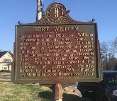
    <title type="html"><![CDATA[Marker #974 Fort William]]></title>
    <summary type="html"><![CDATA[<p><strong><em>Marker # 974 sits on the northwest corner of Shelbyville Road and Whipps Mill Road in Louisville, Kentucky. It sits in the front easement of a stone house next door to a car dealership. Shelbyville Road offers no parking and caution is advised when parking to visit the marker.</em></strong></p><img src="https://explorekyhistory.ky.gov/files/fullsize/00a7ff0bcd1ba16c1a8a9469ce2d5780.jpg" alt="[Untitled]" /><br/><p>Historical Marker #974, “Fort William,” commemorates Colonel William Christian (1743-1786), a Revolutionary War veteran from Virginia who was granted three-thousand acres in Kentucky for his service. Christian brought his family to the Beargrass region of Louisville in 1785.</p><p>According to family genealogy, before Christian turned twenty years old he served in the French and Indian War as a captain in the Second Virginia Infantry. For his service he claimed three thousand acres of land in Bullitt’s Lick, located west of Shepherdsville. Christian was later a colonel in the Fincastle Regiment during Lord Dunmore’s War, where he fought against the French. </p><p>According to Historical Register of Virginians in the Revolution, Christian also served as a first lieutenant in the Continental Line in 1776. He was promoted to colonel, but he declined and resigned. On August 1, 1776, he was appointed colonel and commander in chief of all Virginian forces on westward expeditions against the Cherokee on August 1, 1776.</p><p>Christian was the brother-in-law of Colonel Patrick Henry, commander of the First Virginia Regiment. Christian married Henry’s sister, Ann. </p><p>Christian commanded two expeditions against the Cherokee nation and later led a committee to create a treaty between the Cherokee and the United States. Christian brought his family to Kentucky in 1785, and he later served as a trustee of the Transylvania Seminary, which is now Transylvania University in Lexington. </p><p>On April 9, 1786, Christian was killed while leading a battle against a group of Native Americans who supposedly crossed the Ohio River at Six Mile Island to steal horses. During the battle, four men were killed: Christian, two of the Native Americans, and a “man named Kelly,” who heard the skirmish and ran into the fight. </p><p>Christian died from his wounds at his home and was buried in front of his house, in the Oxmoor Cemetery, off the Beargrass Creek in Jefferson County.</p><p><em><strong><a href="https://explorekyhistory.ky.gov/items/show/1011">For more (including 2 images) view the original article</a></strong></em></p>]]></summary>
    <published>2026-03-30T13:34:56+00:00</published>
    <updated>2026-09-16T16:30:33+00:00</updated>
    <link rel="alternate" type="text/html" href="https://explorekyhistory.ky.gov/items/show/1011"/>
    <id>https://explorekyhistory.ky.gov/items/show/1011</id>
    <author>
      <name>Andy Dickson</name>
    </author>
  </entry>
  <entry>
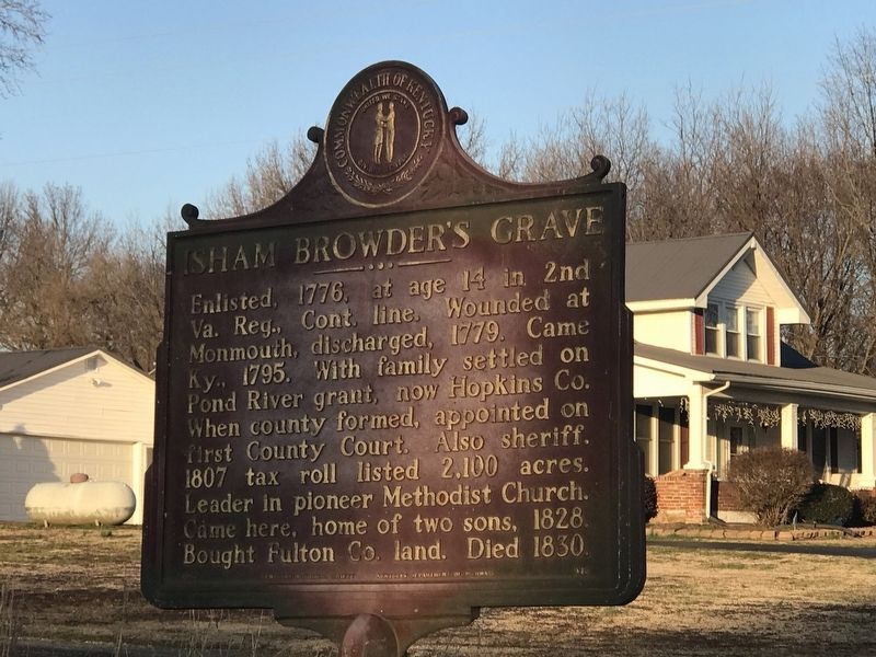
    <title type="html"><![CDATA[Marker #973 Isham Browder&#039;s Grave]]></title>
    <summary type="html"><![CDATA[<p><strong><em>Marker #973 sits on the north side of East State Line Road, the road that divided Kentucky and Tennessee, about 2.8 miles east of Fulton, Kentucky. The marker sits on the west corner of a farm-access driveway. Visitors should be cautious of private-use land when viewing the marker.</em></strong></p><img src="https://explorekyhistory.ky.gov/files/fullsize/5b1a9d027e9caa497492ef6a591289c5.jpg" alt="Marker #973 Isham Browder&#039;s Grave" /><br/><p>Historical Marker #973, “Isham Browder’s Grave,” is dedicated to Private Isham Browder who served in the First Company of the Second Virginia Regiment during the American Revolution. </p><p>The earliest war records for Browder are in the regimental orderly books of Virginia. He likely enlisted near Charleston, South Carolina, before fighting under Captain Alexander Parker at the Battle of Monmouth in 1778. General Charles Lee led the American troops at Monmouth, but Lee was failing until General George Washington arrived to lead the remaining soldiers to victory. In that action Browder was slightly wounded in the arm. He continued to serve for fourteen months after the battle and was discharged from the military on August 30, 1779, after serving three years.</p><p>Browder moved to Kentucky between 1793 and 1795. </p><p>According to records, between 1798 and 1810, Browder secured ten land grants from Virginia totaling 2,153 acres around the Pond River in present-day Hopkins County. He established a major tobacco business and flour mill. Tax listings in 1807 show him owning eight horses and six enslaved African Americans. By 1817, tax records showed his taxable properties as $5,491, a good sum in the early nineteenth century. </p><p>In addition to the land in Kentucky, he was granted one hundred acres in Ohio between the Little Miami and the Scioto Rivers, which he sold to Nathaniel Randolph. Randolph bought approximately two hundred more acres in Ohio, which Browder bought in 1805.</p><p>Shortly after Hopkins County was formed, Governor Christopher Greenup appointed Browder as justice of the peace. Records also show he was the surveyor of proposed roads and inspector of tobacco. </p><p>In 1806, a man described as “tough and wily” named Duncan McArthur purchased about one thousand acres of land in that area, which mistakenly included Browder’s three hundred acres. Browder was not willing to part with the land for the offered price, and they both decided the courts needed to be involved. However, by the time they went to court, Randolph, the previous owner, had died. McArthur claimed there were no fixed landmarks for the property and argued that Browder had improperly surveyed the land. The Ohio courts sided with Browder; however, McArthur appealed to the United States Supreme Court where Chief Justice John Marshall ruled in his favor. The court battles that ensued left Browder bankrupt. To pay for the court cases and lawyers, Browder had to mortgage his properties and auction off his business. McArthur later became governor of Ohio. </p><p>Browder later moved his family to cheaper land in Hickman County, which later became Fulton County. He died on February 19, 1830, and was buried on his farm in Fulton County.</p><p><em><strong><a href="https://explorekyhistory.ky.gov/items/show/1010">For more (including 2 images) view the original article</a></strong></em></p>]]></summary>
    <published>2026-03-30T13:09:18+00:00</published>
    <updated>2026-04-17T19:34:33+00:00</updated>
    <link rel="alternate" type="text/html" href="https://explorekyhistory.ky.gov/items/show/1010"/>
    <id>https://explorekyhistory.ky.gov/items/show/1010</id>
    <author>
      <name>Andy Dickson</name>
    </author>
  </entry>
  <entry>
    <title type="html"><![CDATA[Marker #2667, &quot;The Black Patch War in Fredonia / Rice Tobacco Factory Burned&quot;]]></title>
    <summary type="html"><![CDATA[<p><strong><em>Historical marker #2667 in Caldwell County commemorates the Black Patch War in Fredonia and the burning of the Rice Tobacco Factory. The marker was installed on April 16, 2025, near Fredonia American Legion Post 103 at Buddy Rogers Park, the former site of the Rice Tobacco Factory. The Fredonia Valley Heritage Society held a dedication service for the marker on May 26, 2025. </em></strong></p><img src="https://explorekyhistory.ky.gov/files/fullsize/305fc53c624b316242423121d1318ca4.jpg" alt="Historical marker #2667, side 1. Photo by Pam Faughn." /><br/><p>Tobacco was a major crop in the Fredonia Valley from the time of its settlement by European Americans. When the railroad came to Fredonia in 1887, William Rice, Jr. saw new opportunities for the Fredonia Valley. The advantages local farmers would derive from a home market for their tobacco were numerous. A new town called Kelsey (later annexed into Fredonia) had just been formed between Fredonia and the Fredonia Depot. Here, William Rice and his son purchased three and a half acres of land for a tobacco factory. The building, built in 1888, was a three-story brick and frame structure with a metal roof. It had a capacity of 450 hogsheads. It was the largest building ever located in Fredonia. The warehouse was the only large commercial employer in the area and provided jobs for both men and women.</p><p>An 1893 issue of the Princeton Banner explained that the Rice Tobacco Company owned four stemmeries, including the one in Kelsey. The firm employed about 130 stemmers. In 1893, it paid over $75,000 for tobacco and labor, handling 1,260,000 pounds of tobacco in the process. The firm’s tobacco all went directly to Liverpool, England.</p><p>By 1904, the dark tobacco farmer knew it cost at least six cents per pound to produce the tobacco. But by this time, tobacco was bringing only three to four cents a pound. The price of tobacco was beyond the control of both the farmer and the middleman and was controlled instead by the American Tobacco Trust (the Trust). This monopoly controlled almost all of the tobacco production in the United States and most of England.  </p><p>Tobacco growers formed the Planter’s Protective Association in 1904 in an attempt to organize farmers into marketing cooperatives. In theory, this would empower growers to sell their crops in bulk and afford them greater leverage when confronting the American Tobacco Company. They were not as successful as they hoped and only managed to recruit approximately one third of the growers in the area, perhaps because the Trust had responded by offering higher prices to the growers who refused to join. </p><p>These frustrated and desperate farmers took matters into their own hands. They soon became known as Night Riders, and they began a vigilante campaign against the Trust and those non-cooperative farmers (known as Hillbillies) who refused to join the Association. Soon, night-riding groups sprang up in many areas of the Black Patch region. Throughout the Black Patch, the Night Riders whipped the Hillbillies and trust buyers, scraped plant beds of their young crops, and burned tobacco warehouses and barns. </p><p>By May 1906, Night Rider activity had increased. While Hillbillies now sold their tobacco at ten to twelve cents per pound to the Trust, Association members received just seven and one-eighth cents per pound. The Night Riders started scraping tobacco plant beds of non-members in Lyon and Caldwell counties. Several Hillbilly barns were burned, while scraping plant beds and whipping increased.</p><p>Night Rider activity was not as successful in northern Caldwell County. In the Fredonia Valley between Crider, Fredonia, and Farmersville, two hundred or more farmers refused to join the association or the Night Riders. According to historian James Nall in The Tobacco Night Riders of Kentucky and Tennessee, 1905-1909 (1991), “Henry Wilson, a farmer and stock dealer of Crider, was considered an unofficial leader in that section and was the only person who shot it out with the Night Riders. Although these growers had no organization, mounted groups of six, ten, or twelve men would patrol the area at night when danger threatened; and, as a result of their watchfulness, there were few Night Rider depredations in that area.”</p><p>By November 1906, the Night Riders had decided to burn independent tobacco warehouses in the area. On the night of November 12, 1906, the Rice Tobacco Factory was burned to the ground. The first floor was saturated with coal oil before the Riders’ torches lit the fire from the inside. “It was a large factory, and, although it made a big fire, it burned so rapidly that many citizens two and three blocks away slept through it all,” states Nall.</p><p>The November 13, 1906, issue of the New York Times explained, “The Kelsey Warehouse (Fredonia) was wrecked by dynamite set by the Night Riders. The explosion shattered windows in many houses. Bloodhounds have followed the trail of the wreckers for ten miles into Caldwell County. The stemmery had machinery for steam casing and a drying outfit for tobacco.” The same article mentions that “a letter had been sent to the growers who sold tobacco to the Trust warning them not to sell their tobacco and was signed by the Night Riders. After the warehouse fire, Rice promised not to sell the tobacco in his warehouses to the Trust.” </p><p>This was not the last trip by the Night Riders to Fredonia. In February 1908, the Night Riders took possession of the town while on their way to View in Crittenden County. This brief but shocking instance of mob rule left a deeper impression upon Fredonia’s citizens than the burning of the Rice Tobacco Factory. The Night Riders captured Oscar Scarberry, the Cumberland Telephone and Telegraph night operator, and cut the wires at one o’clock in the morning. Then 75 men rode on to View, five miles away, where A. H. Cardin, the former populist state leader and only buyer of independent tobacco in the area, lived. Upon arriving, they attacked and burned the farm.</p><p>A party of 25 men stood guard in the streets of Fredonia to prevent anyone from giving an alarm to Cardin or alerting the authorities. One rider, after cutting the Cumberland telephone cable, climbed a telephone pole to cut another wire when the pole broke. He was severely injured and taken away by Night Riders. The mob also tore out the telephone in C. B. Lloyd’s store. The clerk at Bugg’s Drug Store built a fire in the stove to keep the raiders warm while they waited for the others to return from View. </p><p>Fredonia was held captive for three hours. These facts represent one of the most noteworthy historical events ever experienced by this small town.</p><p>The marker text reads:</p><p>THE BLACK PATCH WAR IN FREDONIA</p><p>Farmers in western Ky. and Tenn. fought with buyers over the price of their tobacco from 1904-1909. The farmers created the Planters’ Protective Assn. to challenge the American Tobacco Co.’s monopoly on the cash crop, but many farmers refused to join. To compel their cooperation, vigilantes known as Night Riders scraped plant beds and burned barns and warehouses.</p><p>RICE TOBACCO FACTORY BURNED</p><p>While Night Riders were not as successful in northern Caldwell County, they did visit Fredonia twice during the Black Patch War. On Nov. 12, 1906, they burned the Rice Tobacco Factory at this site. In Feb. 1908, they cut phone lines and held Fredonia captive for 3 hours while others rode to nearby View, Ky., to burn the property of tobacco buyer A. H. Cardin.</p><p><em><strong><a href="https://explorekyhistory.ky.gov/items/show/1009">For more (including 3 images) view the original article</a></strong></em></p>]]></summary>
    <published>2026-03-05T20:44:02+00:00</published>
    <updated>2026-04-17T19:34:33+00:00</updated>
    <link rel="alternate" type="text/html" href="https://explorekyhistory.ky.gov/items/show/1009"/>
    <id>https://explorekyhistory.ky.gov/items/show/1009</id>
    <author>
      <name>Pam Faughn, Fredonia City Historian and President, Fredonia Valley Heritage Society</name>
    </author>
  </entry>
  <entry>
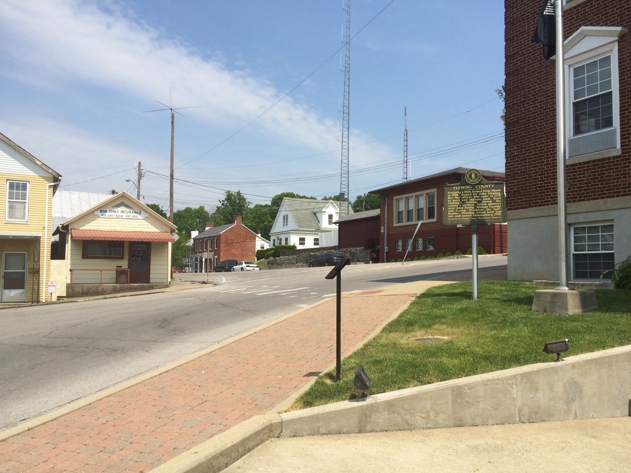
    <title type="html"><![CDATA[Marker #950 Fleming County]]></title>
    <summary type="html"><![CDATA[<p><strong><em>Marker #950 sits at the corner of Fleming County Courthouse on the west corner of the building around Court Square between West Main Street and South Main Cross Street. Court Square is a typical courthouse round-a-bout in the middle of the Flemingsburg. Parking around the court is not available, however it may be best to check with the local businesses for temporary parking.</em></strong></p><img src="https://explorekyhistory.ky.gov/files/fullsize/fad9640cea3581bdc5a4deac70ed0f30.jpg" alt="[Untitled]" /><br/><p>Historical Marker #950, “Fleming County,” is dedicated to Colonel John Fleming, a Revolutionary War veteran, surveyor, and early Kentuckian. Fleming County and Flemingsburg are named for him.</p><p>Fleming was born in Virginia in 1735. His father died shortly after, and his mother remarried in 1740. Within five years, Fleming had three half-siblings, and he moved in with his grandparents who raised him. Fleming grew up working on a farm and operating a nearby ferry. </p><p>Fleming learned about the 1773 William Thompson expedition into Kentucky from William McClary, who had secured a 3,000-acre survey on the waters of Salt Lick Creek. The Thompson survey was tasked with locating lands for militia officers who served in the French and Indian Wars. In 1776, Fleming joined McClary on a trip down the Ohio River to further explore and make improvements on McClary’s land. Other settlers also hired them to make improvements to their land. </p><p>Fleming and McClary stayed in Kentucky for about two months, building a small log cabin near Fleming Creek and four more on the North Fork of the Licking River. They built approximately thirty log cabins as improvements for claims in the future, including some at Big Spring for George Stockton, the future founder of Flemingsburg. </p><p>Fleming stayed in Stockton’s cabin, while the rest of his party left, presumably to retrieve their families. Fleming traveled with Simon Kenton and William Kennedy to neighboring stations, including Ruddle’s Station and Fort Harrod. Upon reaching Fort Harrod, he joined the local militia to protect the settlement from Native American attacks and was appointed captain. </p><p>Around 1780, Fleming joined Colonel George Rogers Clark’s expeditions into the Illinois Territory during part of the western wars of the Revolution. He then went to Pennsylvania for a short time after his discharge. In 1780, he commanded one of the boats in Jacob Van Meter’s party traveling down the Ohio River to Louisville.</p><p>Accompanying Fleming was Samuel Strode, who was returning to secure land granted by the Virginia Land Act of May 1779. Fleming then went to Strode’s Station, built by John and James Strode in 1779, and helped defend that location in 1781.</p><p>In 1782, Fleming married Lucy Pettit Donaldson, who had six daughters and two sons from her first husband, Patrick Donaldson, who had been killed in the siege at Strode’s Station.</p><p>Shortly after his marriage, Fleming and a party, including his stepson, John Donaldson, went back to Fleming County to locate lands for future settlements. When the party arrived in August 1782, they encountered a group of Native Americans. In the ensuing fight, Fleming was shot in the hip. He returned to Strode’s Station, where he recovered.</p><p>Governor Thomas Jefferson, Virginia’s second governor and future president, sent Thomas Marshall to open the first county surveyor’s station in Fayette County. Marshall appointed Fleming as one of his deputy surveyors. Fleming completed surveys on Lower Howard Creek, Grassy Creek, present-day Somerset, and around the waters of the Hinkston. In 1784, Fleming and a party of others went back to Fleming County and made the first official survey there. It was during this time that Fleming Creek was given its name. Fleming completed his work as a Fayette County surveyor in 1786, when the area in which he was living became Bourbon County. In 1787, he became the deputy surveyor of Bourbon County. </p><p>In the spring of 1788, it is presumed that Fleming spent his time building Fleming’s Station, near Martha Hills in Fleming County. In 1791, he died in Fayette County. His cause of death is debated; some say it was during a surveying trip, but others claimed that he instead died at his stepson’s home. He was buried in a family cemetery in Fayette County.</p><p>George Stockton founded a town near Fleming’s preemption in 1796. In 1798, Michael Cassiday, a representative from Mason County, made sure the new town was named Flemingsburg, after their friend John Fleming.</p><p><em><strong><a href="https://explorekyhistory.ky.gov/items/show/1008">For more (including 2 images) view the original article</a></strong></em></p>]]></summary>
    <published>2025-12-09T20:16:32+00:00</published>
    <updated>2026-04-17T19:34:33+00:00</updated>
    <link rel="alternate" type="text/html" href="https://explorekyhistory.ky.gov/items/show/1008"/>
    <id>https://explorekyhistory.ky.gov/items/show/1008</id>
    <author>
      <name>Andy Dickson</name>
    </author>
  </entry>
  <entry>
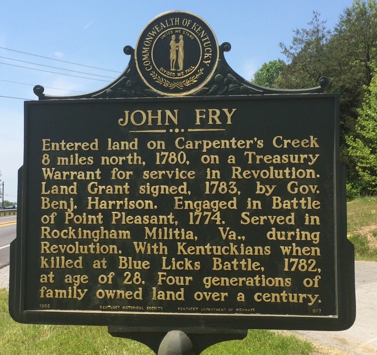
    <title type="html"><![CDATA[Marker #917 John Fry]]></title>
    <summary type="html"><![CDATA[<p><strong><em>Marker #917 sits near the intersection of N. Wallace Wilkinson Boulevard and Leonard Wilkinson Way. The marker is across the road from the three-way intersection in a grass area near a public parking area. The parking is as across from the intersection.</em></strong></p><img src="https://explorekyhistory.ky.gov/files/fullsize/80cee216b112b7f59bbc9dfec8f0cf50.jpg" alt="[Untitled]" /><br/><p>Historical Marker #917, “John Fry” in Casey County, Kentucky, references John Fry (or Frye), a veteran of Lord Dunmore’s War and the Revolutionary War.</p><p>Fry is listed as a private in the September 1774 volunteer rolls of Captain William Nalls’ company from Augusta, Virginia, in Lord Dunmore’s War. This conflict began when Virginia Governor John Murray, fourth Earl of Dunmore, declared war on the Shawnee and Mingo tribes of the trans-Appalachian region. The war ended at the Battle of Point Pleasant in Virginia. It resulted in the establishment of a boundary between the Shawnee and Mingo tribes and the Virginia colonists at the Ohio River and the establishment of Kentucky as a county of Virginia. Fry was given land in Kentucky as part of his service in the war.</p><p>After Dunmore’s War, Fry was granted about 400 acres on Carpenter’s Creek in Lincoln County, one of the three counties in Kentucky before statehood.  </p><p>Fry’s year of birth is currently unknown, but it is speculated he was born in either 1753 or 1754. According to findagrave.com, he was killed at the age of 27 or 28. The date of his death and location is confirmed by Bennett H. Young’s History of the Battle of Blue Licks in a roster of those killed on August 19, 1782, during the Battle of Blue Licks. Fry served under the command of Colonel Daniel Boone during the battle. The Battle of Blue Licks, to many Kentuckians, was the last battle of the American Revolution. Although the battle was a military disaster for the Kentucky militia, the outcome had no effect on the revolution. The British had already surrendered the war at Yorktown. However, this battle created greater tensions between Kentuckians and the Native Americans that would continue into the War of 1812. Fry was buried by his comrades on the Blue Licks battlefield.</p><p>After Fry’s death, his wife, Catherine Spears, remarried Adam Carpenter, who lived in the Carpenter’s Creek area of what is now Casey County. Catherine and the Carpenter family  lived on the land for many generations. Fry’s estate was left to Catherine, who began combining the land holdings from Fry and Adam, who died in 1806. Catherine used the land for farming and business dealings; she began distilling whiskey and created textile dyes, cocktail bitters, and homemade medicines. Catherine’s recipes and a large collection of her papers are held by the Kentucky Historical Society.</p><p><em><strong><a href="https://explorekyhistory.ky.gov/items/show/1007">For more view the original article</a></strong></em></p>]]></summary>
    <published>2025-11-24T13:55:15+00:00</published>
    <updated>2026-04-17T19:34:33+00:00</updated>
    <link rel="alternate" type="text/html" href="https://explorekyhistory.ky.gov/items/show/1007"/>
    <id>https://explorekyhistory.ky.gov/items/show/1007</id>
    <author>
      <name>Andy Dickson</name>
    </author>
  </entry>
  <entry>
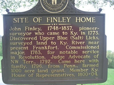
    <title type="html"><![CDATA[Marker #789 Site of Finley Home]]></title>
    <summary type="html"><![CDATA[<p><strong><em>Marker #789 stands near the end of Hilltop Road southeast of Flemingsburg. Hilltop Road dead ends at the Licking River. The marker is right past the address of 6543 Hilltop Road, a private property. </em></strong></p><img src="https://explorekyhistory.ky.gov/files/fullsize/bb2108cdf63f2dbe0664c663a53b80fc.jpg" alt="[Untitled]" /><br/><p>Historical Marker #789, “Site of Finley Home,” located at the end of Hilltop Road at the Licking River in Fleming County. This marker commemorates John Finley, a veteran of the French and Indian War (1754-1763) and a Kentucky legislator. Born in Shippensburg, Pennsylvania, on July 17, 1748, before coming to Kentucky Finley traded cattle to the French near the Great Lakes.</p><p>After serving in the French and Indian War, in 1773, Finley traveled down the Ohio River with a party led by Captain William Thompson. The men ventured to the mouth of Cabin Creek, where they began surveying land. Finley and a few others then explored Licking Creek, where they surveyed and marked both the  Upper Blue Lick and the Lower Blue Lick. </p><p>These surveys continued until they encountered Native Americans. Finley, who knew some native language after trading in the Great Lakes area, understood that the Native Americans did not want them there. Finley refused to leave, and when the tribes saw they were outnumbered, they retreated. Finley and Thompson, fearing more would arrive, headed back to Ohio to safer lands.</p><p>When Finley did return to Kentucky, he learned that Virginia did not recognize the surveys because they were not commissioned by Virginia. However, Finley had made land improvements to areas he had surveyed on the Upper Blue Licks, which, according to the 1779 Land Acts, made him eligible to claim most of the land. </p><p>In 1789, Finley joined Colonel James Garrard and marked land in what is now Fleming and Nicholas counties. Again, worries of Native American attacks made it nearly impossible to remain in the area. Finally, in 1796, he settled in Fleming County with his family along the Licking River and built a two-story home. The only remnants remaining today are the Finley graveyard. </p><p>In 1798, Finley was appointed as an overseer of the road he resided. A year later, the county named him as a member of the board of land arbitrators. In 1800, he was elected as a state representative, serving until 1804. At the time, he was also the local justice of the peace.</p><p>In 1809, Finley established a tavern near his home, since it was a popular place for a ferry on the Upper Blue Licks. Moreover, travelers frequently visited the area to procure salt from the licks. About six years later, Finley moved about a mile north from his home and tavern.</p><p>Finley’s property lines were heavily contested as they conflicted with claims surveyed by other people, including John Durham. For many years, Finley and Durham had been in and out of the courts over land disputes. In 1836, Finley eventually resigned his claims; he was over seventy years old and his eyesight was failing. He sold off the remaining land to his son-in-law, John Peebles. </p><p>During his last remaining years, Finley led a quiet life. Often, his neighbors visited him and read his favorite books to him (Washington and Marion by Parson Weems). Finley passed away on April 10, 1837. He was buried in the Finely cemetery near his first home, where the historical marker is posted at the end of the road.</p><p>Finley was survived by his wife, Hannah Duncan Finley, the daughter of David Duncan, another member of Thompson’s surveying party.</p><p><em><strong><a href="https://explorekyhistory.ky.gov/items/show/1005">For more view the original article</a></strong></em></p>]]></summary>
    <published>2025-11-17T19:00:37+00:00</published>
    <updated>2026-04-17T19:34:33+00:00</updated>
    <link rel="alternate" type="text/html" href="https://explorekyhistory.ky.gov/items/show/1005"/>
    <id>https://explorekyhistory.ky.gov/items/show/1005</id>
    <author>
      <name>Andy Dickson</name>
    </author>
  </entry>
  <entry>
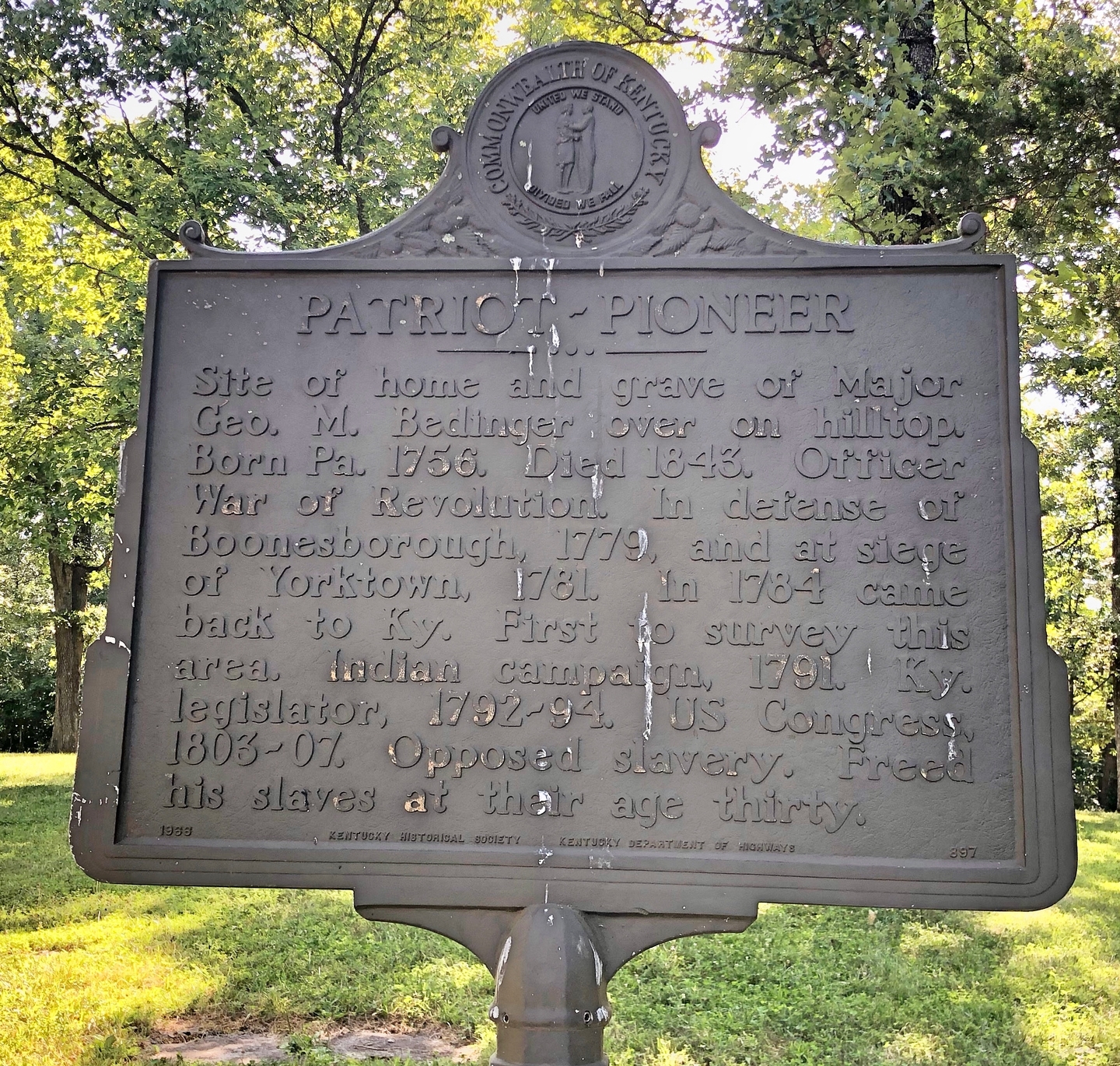
    <title type="html"><![CDATA[Marker #897 Patriot-Pioneer]]></title>
    <summary type="html"><![CDATA[<p><strong><em>Marker #897 stands to the east of Main Park Road across from the intersection connected with Lodge Road near Carlisle, Kentucky. This intersection is approximate to the entrance of Blue Licks Battlefield State Resort Park.</em></strong></p><img src="https://explorekyhistory.ky.gov/files/fullsize/f8f4ac631a974b24e534d5dd92a4d729.jpg" alt="[Untitled]" /><br/><p>Historical Marker # 897, “Site of Home and Grave of Major George M. Bedinger,” was erected to memorialize Michael George Michael Bedinger, who was born to German parents in York County, Pennsylvania, on December 10, 1756. Bedinger was a Revolutionary War veteran who also served in the Kentucky General Assembly and the U.S. Congress. </p><p>Bedinger volunteered for service during the Revolution, enlisting around 1776. He was involved in several minor skirmishes that were, in his terms, small tours of duty – three to six months at a time. In 1779, as a major, he became adjutant to Colonel John Bowman. Because the British were using Native Americans to attack colonists, Bedinger fought against the Chillicothe, a band of the Shawnee.  In 1781, he served in a Virginian regiment at the siege of Yorktown. According to Bedinger, “We were the first to approach the enemy at York.”</p><p>At various times, Bedinger was in Kentucky, often settling at Fort Boonesboro. He served on hunting parties, lookouts, and was even their commissary, which included rationing salt from North Carolina. </p><p>A trusted leader, Bedinger was elected to represent Kentucky in the U.S. Congress from 1803 to 1807 as a Jeffersonian-Republican. He was noted to have similar views on slavery as George Washington, a man he admired greatly. He wanted to free his slaves as soon as possible, but only wanted to do so while the law could grant them freedom. While in Congress, he helped pass a bill to prevent the transportation of new slaves into the United States. </p><p>Bedinger married twice, first to Nancy Keene in 1786, who died young from illness. They had one child together. In 1793, he married Henrietta Clay, with home he had nine children. Bedinger settled down as a farmer in Kentucky and died on December 7, 1843. He was buried in his family cemetery in the Lower Blue Lick Springs.</p><p><em><strong><a href="https://explorekyhistory.ky.gov/items/show/1004">For more (including 2 images) view the original article</a></strong></em></p>]]></summary>
    <published>2025-11-13T15:31:44+00:00</published>
    <updated>2026-04-17T19:34:33+00:00</updated>
    <link rel="alternate" type="text/html" href="https://explorekyhistory.ky.gov/items/show/1004"/>
    <id>https://explorekyhistory.ky.gov/items/show/1004</id>
    <author>
      <name>Andy Dickson</name>
    </author>
  </entry>
  <entry>
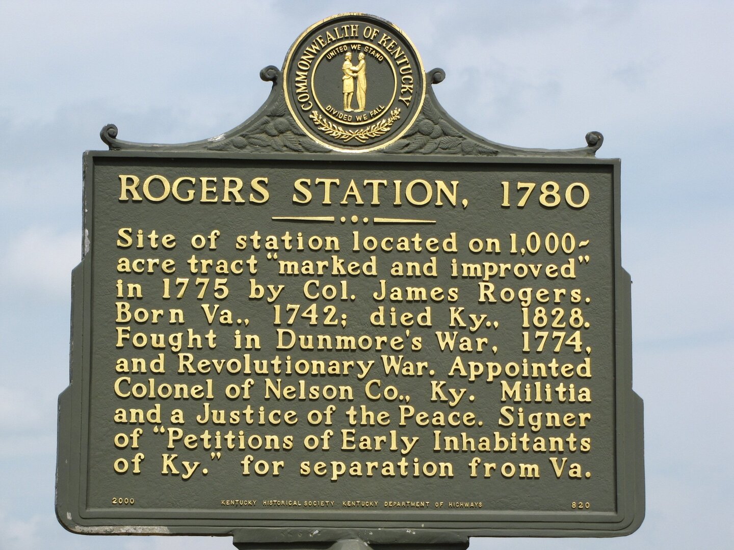
    <title type="html"><![CDATA[Marker #820 Roger&#039;s Station]]></title>
    <summary type="html"><![CDATA[<p><strong><em>Marker #820 stands on the northeast corner of Boston Road and Airport Road on the west side of Bardstown, Kentucky next to a crop field.</em></strong></p><img src="https://explorekyhistory.ky.gov/files/fullsize/d43a6ea469ff997157bbeec9a1ae545d.jpg" alt="Roger&#039;s Station" /><br/><p>Historical Marker #820, “Rogers’ Station,” examines Colonel James Rogers, a Revolutionary War veteran, Kentucky settler, early Kentucky politician, and church leader, who was born in 1742. Rogers was best remembered for early settlements in Jefferson County and Nelson County, especially the establishment of Rogers’ Station, two miles north of the Beech Fork River. Rogers’ Station was one of the earliest settlements in Nelson County.</p><p>Rogers’ birthplace appears to be contested, based on sources. According to Lon B. Rogers, James was born “probably in Virginia,” while J. H. Spencer writes that James “was born, either in Ireland, or of Irish parents, in Maryland, about the year 1742.” </p><p>Rogers served in the Revolutionary War with the Fincastle Militia under Captain Daniel Smith in 1774. He was also a captain at Catfish Camp, District of West Augusta, in early 1777. West Augusta later became known as Augusta Town and now Washington, Pennsylvania. When Rogers migrated to Kentucky (then part of the Old Dominion), Virginia Governor Patrick Henry appointed him as lieutenant colonel in the Kentucky militia. </p><p>Rogers moved to Kentucky in 1780. His party included William Keith, Evan Williams (of the bourbon brand fame), and several others. He was given a preemption, or settlement right, for 1,000 acres along Cedar Creek where he established Rogers’ Station. His patent was settled in 1782. In the notes by Lon B. Rogers, at the time there were approximately five settlements within the present boundaries of Nelson County.</p><p>When the governor of Virginia approved the boundaries of Nelson County in 1784, he appointed Rogers, Isaac Cox, and several others to serve as justices of the peace. Rogers also served on the committee to create the first courthouse in Nelson County. As Kentucky began to grow, Rogers was one of the signers of the petition for Kentucky statehood and was involved in two out of the ten constitutional conventions to help Kentucky establish its own government.</p><p>Rogers also established churches in his area of Kentucky.  He is listed in the constitution of the Cedar Creek Baptist Church, dated July 4, 1781, which was the second Baptist church in Kentucky. This church was a part of the Salem Association in 1792. The South District Association met at Rogers’ home in 1790 and again in 1792. Two years later they were granted a license to give rites of matrimony. He was also one of six ministers at the South District Association in current Marion County. He performed marriages and was active in spreading the Baptist faith for the remainder of his life.</p><p>Rogers was married twice, first to Martha Blackburn in 1766. They had eight children together. Blackburn passed in 1818, and Rogers moved to Mercer County, where he met and married Nancy Flournoy in 1820. </p><p>Colonel James Rogers passed away in Mercer County on March 24, 1828.</p><p><em><strong><a href="https://explorekyhistory.ky.gov/items/show/1003">For more view the original article</a></strong></em></p>]]></summary>
    <published>2025-11-13T15:05:55+00:00</published>
    <updated>2026-04-17T19:34:33+00:00</updated>
    <link rel="alternate" type="text/html" href="https://explorekyhistory.ky.gov/items/show/1003"/>
    <id>https://explorekyhistory.ky.gov/items/show/1003</id>
    <author>
      <name>Andy Dickson</name>
    </author>
  </entry>
  <entry>
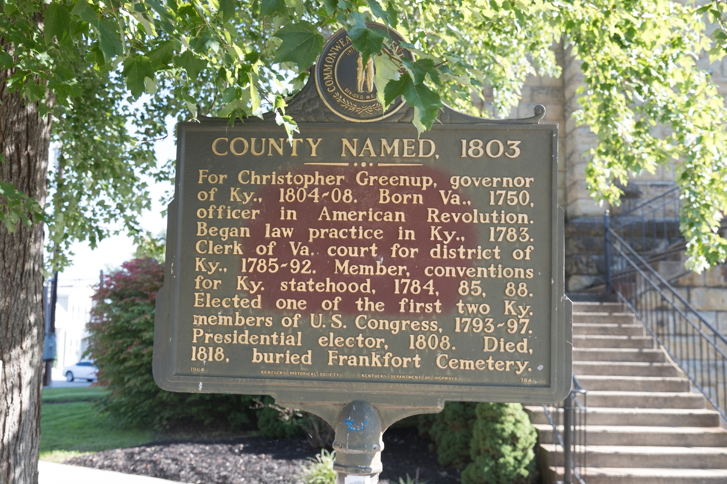
    <title type="html"><![CDATA[Marker #784 County Named, 1803]]></title>
    <summary type="html"><![CDATA[<p><strong><em>Marker #784 stands on the northeast corner of Main Street and Washington Street in front of the Greenup County Courthouse.</em></strong></p><img src="https://explorekyhistory.ky.gov/files/fullsize/df8f6f60e74664bfb04e47950042d7a5.jpg" alt="County Named, 1803" /><br/><p>Historical Marker #784, “County Named, 1803,” commemorates the naming of Greenup County, Kentucky, after Christopher Greenup, the third governor of the Bluegrass State. In addition to being the commonwealth’s chief executive, Greenup was a veteran of the Revolutionary War, a lawyer, a member of the Virginian House of Delegates, a U.S Representative, a state representative and Kentucky senator, and one of the original trustees for Transylvania University in Lexington.</p><p>Greenup County, established in 1803, was the forty-fifth county formed in Kentucky. It was formed out of Mason County in the Appalachian region. </p><p>Born in Virginia in 1750, Greenup studied law and surveying before being commissioned as a lieutenant in the Virginia militia. He was later promoted to colonel during the Revolutionary War. Greenup moved to Lincoln County, Kentucky, in 1781 and practiced law. Before Kentucky was a state, he represented Fayette County in the Virginia legislature. Between back-and-forth trips from Kentucky to Virginia, Greenup served in two of the Danville constitutional conventions that led to Kentucky’s statehood. </p><p>After Kentucky became a state, Greenup continued his career in politics. He moved to Frankfort in 1792 and was soon elected as a member of the U.S. Congress as a Jeffersonian-Republican, serving between 1792 and 1797. Once his term was over, he moved back to Frankfort to work in the Kentucky legislature as a clerk in the state senate. In 1800, he ran his first governor’s race and was defeated by James Garrard.</p><p>By 1804, Greenup’s political popularity increased. He again ran for governor, this time unopposed. He served as Kentucky’s third governor from 1804 to 1808. </p><p>Greenup wanted some major reforms in Kentucky, including the establishment of the Kentucky militia. He also supported the state providing public education but was ultimately unsuccessful in getting that legislation passed. </p><p>Greenup was also caught in the middle of a national scandal involving Aaron Burr, vice-president of the United States at the time. Burr was accused of attempting to start a war with Mexico and Spain, an event known as the Burr Conspiracy. Greenup testified in a legislative hearing, and he worked with the legislature to put the Kentucky militia along the Ohio River to prevent war. The U.S. Congress cleared Greenup of any charges, and he ended his gubernatorial term with high approval from Kentuckians.</p><p>Greenup died in Frankfort on April 17, 1818, and was buried in the Frankfort Cemetery.</p><p><em><strong><a href="https://explorekyhistory.ky.gov/items/show/1002">For more (including 2 images) view the original article</a></strong></em></p>]]></summary>
    <published>2025-11-12T20:24:19+00:00</published>
    <updated>2026-04-17T19:34:33+00:00</updated>
    <link rel="alternate" type="text/html" href="https://explorekyhistory.ky.gov/items/show/1002"/>
    <id>https://explorekyhistory.ky.gov/items/show/1002</id>
    <author>
      <name>Andy Dickson</name>
    </author>
  </entry>
  <entry>
    <title type="html"><![CDATA[Marker #729 &quot;Pioneer&quot; Ward: Historical Marker #729 stands on the southeast corner of West Main Street and Holy Street in front of the Martin County Courthouse. ]]></title>
    <summary type="html"><![CDATA[<img src="https://explorekyhistory.ky.gov/files/fullsize/28d7d13e7f0def1338eda27a32183616.jpg" alt="Pioneer Ward" /><br/><p>Historical Marker #729, “James ’Pioneer’ Ward,” commemorates Revolutionary War veteran James Ward, a member of the Virginia militia who moved to Kentucky in 1780. In addition to fighting in the American Revolution, Ward battled Native Americans and served in the Kentucky legislature.  He also served as one of eleven pallbearers for Daniel Boone’s casket when Boone was reinterred in Frankfort, Kentucky, in 1845.</p><p>Ward was born in Virginia on September 19, 1763. Two years after his father was killed at the 1774 battle of Point Pleasant, Ward enlisted as a private in the Virginia militia and served in the American Revolution. In 1780, Ward and his brothers explored Kentucky and settled in current-day Mason County. </p><p>Ward and his brothers joined several expeditions, including one with Colonel Benjamin Logan as a captain in one of Logan Raids. He also served with Simon Kenton to retrieve stolen horses from the Shawnee in Ohio. There, Ward met White Wolf, previously known as John Ward. This was James’ older brother, whom the Shawnee had kidnapped when John was three years old. John was adopted into the Shawnee and married a Shawnee woman. While negotiating with the tribe, a fight broke out. White Wolf was fatally injured.</p><p>Ward also served under General “Mad” Anthony Wayne at the Battle of Fallen Timbers in 1794.</p><p>Ward served Mason County as a Kentucky representative in the 1810, 1816, and 1818 sessions and in the state senate from 1823 through 1827.</p><p><em><strong><a href="https://explorekyhistory.ky.gov/items/show/1001">For more (including 2 images) view the original article</a></strong></em></p>]]></summary>
    <published>2025-11-12T19:34:51+00:00</published>
    <updated>2026-04-17T19:34:33+00:00</updated>
    <link rel="alternate" type="text/html" href="https://explorekyhistory.ky.gov/items/show/1001"/>
    <id>https://explorekyhistory.ky.gov/items/show/1001</id>
    <author>
      <name>Andy Dickson</name>
    </author>
  </entry>
  <entry>
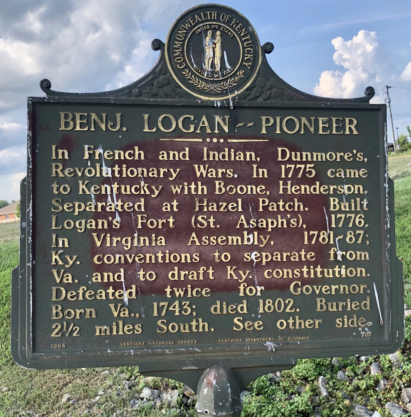
    <title type="html"><![CDATA[Marker #709 Benj. Logan -- Pioneer]]></title>
    <summary type="html"><![CDATA[<p><strong><em>Historical Marker #709 stands on the north west corner of Taylorsville Road and Brunerstown Road just south of the Interstate 64 intersection of Taylorsville Road.</em></strong></p><img src="https://explorekyhistory.ky.gov/files/fullsize/39809e3ca681ce52ee99907deb65a694.jpg" alt="Benj. Logan -- Pioneeer" /><br/><p>Historical Marker #709, “Benj. Logan – Pioneer,” stands at the intersection of Taylorsville Road and Brunerstown Road in Shelbyville, Kentucky. This marker lists two Revolutionary War veterans who settled in Kentucky: Benjamin Logan and James Knox.</p><p>General Benjamin Logan, best known as an early Kentucky frontiersman and legislator, was Kentucky County, Virginia’s first sheriff (before statehood) and one of four military captains in the region. Logan was also served on eight out of ten constitutional conventions to turn Kentucky County into a state. He was an early member of the Kentucky General Assembly—serving multiple terms—and was a member of the convention to write Kentucky’s second constitution.</p><p>Born in Orange County, Virginia, in 1743, Logan enrolled in the Virginia militia at age sixteen and served under Colonel Henry Bouquet in Pontiac’s War. By 1774, Logan was promoted to captain and fought in Ohio under Lord Dunmore’s orders. In 1775, Logan helped start a settlement near present-day Stanford, Kentucky, called St. Asaph, which was also called Logan’s Fort. </p><p>In 1779, Logan served with Colonel John Bowman as one of the three militia leaders on an expedition into the Shawnee country north of the Ohio River. After being promoted to colonel in 1780, Logan became second-in-command to Colonel George Rogers Clark during a second Shawnee campaign.</p><p>In 1781, voters elected Logan to the Virginia Assembly as a delegate from Lincoln County. Virginia Governor Thomas Jefferson then appointed Logan as the militia commander for Lincoln County.  </p><p>After Kentucky gained statehood, a new county was formed from Lincoln County and named Logan County in Benjamin’s honor. Isaac Shelby, Kentucky’s first governor, placed Logan in command of a full division of the state militia, granting him the rank of general. Concurrently, Logan served in the Kentucky General Assembly and assisted in writing Kentucky’s second constitution.</p><p>Logan was married to Ann Montgomery and had nine children. He passed away on December 11, 1802.</p><p>Historical marker #709 also commemorates Colonel James Knox, a Long Hunter and colleague of Benjamin Logan. Knox led a party of forty Long Hunters through the Cumberland Gap and into Kentucky in 1769. In 1770 and 1771, he hunted and explored around the Green River area. Knox reportedly returned to Virginia in 1776 to command one of the companies of the 8th Virginia Regiment in the Revolutionary War. Knox’s unit suffered many casualties from malaria while moving through South Carolina. He commanded a company at during the Battle of Saratoga. After the war, he moved back to Kentucky to continue exploration. </p><p>Knox was not just a Long Hunter and woodsman, but he ventured into politics as Kentucky moved into statehood. He served in the Virginia legislature in 1788 and then was a Kentucky senator from 1795 to 1800. </p><p>After Benjamin Logan died in 1802, Knox married Logan’s widow, Ann, in 1805. Knox died in 1822.</p><p><em><strong><a href="https://explorekyhistory.ky.gov/items/show/1000">For more (including 2 images) view the original article</a></strong></em></p>]]></summary>
    <published>2025-11-12T19:06:22+00:00</published>
    <updated>2026-04-17T19:34:33+00:00</updated>
    <link rel="alternate" type="text/html" href="https://explorekyhistory.ky.gov/items/show/1000"/>
    <id>https://explorekyhistory.ky.gov/items/show/1000</id>
    <author>
      <name>Andy Dickson</name>
    </author>
  </entry>
  <entry>
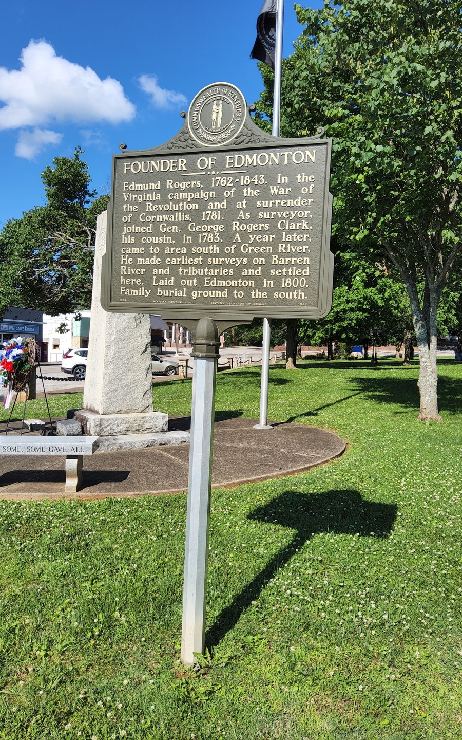
    <title type="html"><![CDATA[Marker #678 Founder of Edmonton]]></title>
    <summary type="html"><![CDATA[<p><strong><em>Historical Marker #678 stands on the southeast corner of South Main Street and East Stockton Street in Edmonton, Kentucky.</em></strong></p><img src="https://explorekyhistory.ky.gov/files/fullsize/d801522c0971cc0442afbabd926dc2ae.jpg" alt="Founder of Edmonton" /><br/><p>Historical Marker #678 “Founder of Edmonton” is named after Edmund Rogers, Revolutionary War veteran from Virginia, arrived in Kentucky in 1783 as a surveyor with his cousin, George Rogers Clark. While surveying, he selected a spot for himself around the South Fork of Little Barren River. By the early 1800s, this area became known as Edmonton, a community that was named for him. </p><p>As a soldier in Virginia, Rogers served in the capture of British Gen. Charles Cornwallis and the battles of Jamestown, Green Springs, and the siege of York, all in Virginia. Although Congress had funded pensions for Revolutionary War veterans, Rogers refused to apply for one. </p><p>Rogers began surveying north of the Ohio River with Clark in 1783 and worked his way toward the Green River. According to the Metcalfe County Historical Society, Rogers felt that divine intervention led him his homestead. While surveying, he supposedly fell off a log into a creek. John Shirley lived in the area and Rogers went to Shirley’s home to dry off his clothes and surveying records. There, he met Shirley’s daughter, Mary. </p><p>Because Rogers’ surveying papers were wet, he returned to a local station to salvage his work. He met another surveyor and traded papers and land warrants for the area known as “Edmunton”. </p><p>Rogers is often described as a man of great character who acted kindly toward others and held a strict love of justice. In fact, he served as justice of the peace in Barren County but resigned after becoming disillusioned with the proceeding of his first trial.  He resolved to never hold office again and kept to his word. Rogers passed away in 1843 and was buried on his farm.</p><p><em><strong><a href="https://explorekyhistory.ky.gov/items/show/999">For more view the original article</a></strong></em></p>]]></summary>
    <published>2025-11-12T18:49:07+00:00</published>
    <updated>2026-04-17T19:34:33+00:00</updated>
    <link rel="alternate" type="text/html" href="https://explorekyhistory.ky.gov/items/show/999"/>
    <id>https://explorekyhistory.ky.gov/items/show/999</id>
    <author>
      <name>Andy Dickson</name>
    </author>
  </entry>
  <entry>
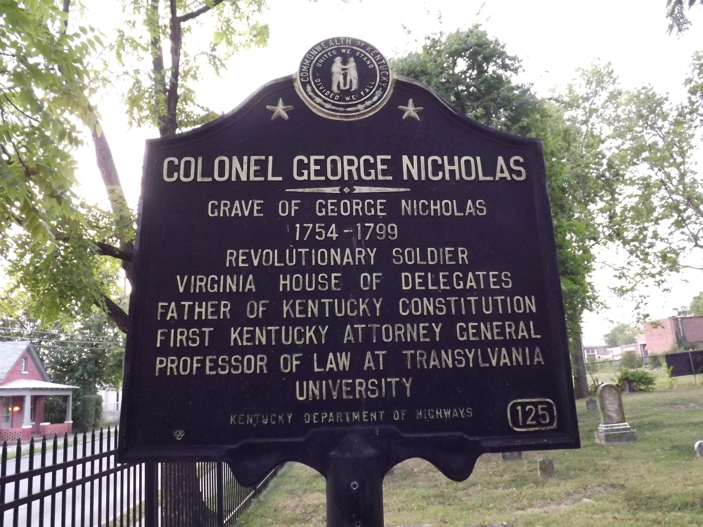
    <title type="html"><![CDATA[Marker #125 Colonel George Nicholas]]></title>
    <summary type="html"><![CDATA[<p><strong><em>Historical Marker  #125 stands outside of the cemetery of the Episcopal Church on East 3rd Street in Lexington, Kentucky.</em></strong></p><img src="https://explorekyhistory.ky.gov/files/fullsize/f0bb33719f3ed6e498f3bd2fca58caed.jpg" alt="Colonel George Nicholas" /><br/><p>Historical Marker #125 is dedicated to Colonel George Nicholas who was born in Williamsburg, Virginia to Robert Carter and Anne (Carey) Nicholas. George Nicholas gained the rank of lieutenant colonel serving in the Revolutionary War and became a member of the Virginia legislature and the constitutional ratification convention in 1788.</p><p>Nicholas moved to Danville, Kentucky in 1788. He used his expertise in government to help establish an organized government in Kentucky. He was on the convention to draft the first Kentucky constitution in 1792 and served as the state’s first attorney general. Nicholas upheld the opinion of more states’ rights. Upon his resignation on December 7, 1792, he practiced law in Lexington.</p><p>Nicholas was hired by Transylvania University in Lexington as their first law professor in 1799. Nicholas was described as having a genius of the likes of James Madison and a charismatic personality. He also was described as having a rememberable impression on his students. </p><p>However, Nicholas died in that same year and buried in the Third Street Cemetery. When Bourbon and Mason counties divided their land to form a new county, Nicholas County was created in his name. Nicholasville, in Jessamine County, was also named after him.</p><p>Nicholas' son followed in his father’s footsteps to eventually become a lawyer and later became the first president of the University of Louisville.</p><p><em><strong><a href="https://explorekyhistory.ky.gov/items/show/998">For more (including 2 images) view the original article</a></strong></em></p>]]></summary>
    <published>2025-11-12T18:19:09+00:00</published>
    <updated>2026-04-17T19:34:33+00:00</updated>
    <link rel="alternate" type="text/html" href="https://explorekyhistory.ky.gov/items/show/998"/>
    <id>https://explorekyhistory.ky.gov/items/show/998</id>
    <author>
      <name>Andy Dickson</name>
    </author>
  </entry>
  <entry>
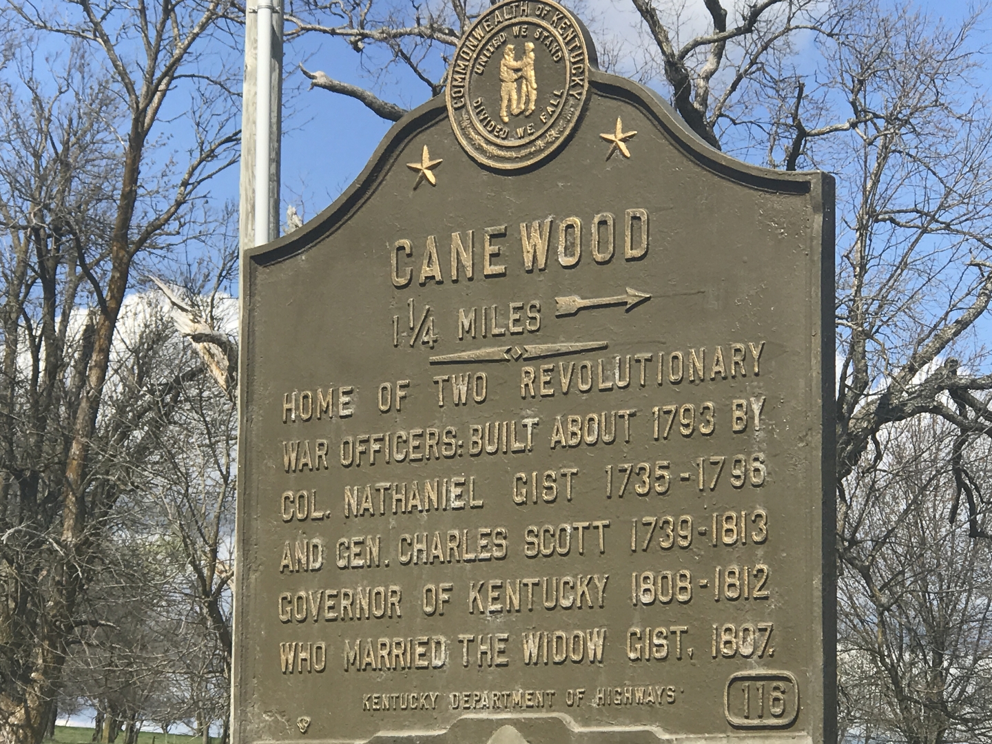
    <title type="html"><![CDATA[Marker #116 &quot;Canewood&quot;]]></title>
    <summary type="html"><![CDATA[<p><strong><em>Historical Marker #116 is located in Clark County, Kentucky on KY 627, approximately 6.5 miles north of Winchester.</em></strong></p><img src="https://explorekyhistory.ky.gov/files/fullsize/66fff3d617c51ff8702a61ab5f4823d6.jpg" alt="Canewood Historical Marker" /><br/><p>Historical Marker # 116 “Canewood,” marks the home in Clark County named after the natural Kentucky cane bamboo growing on the property, was built in 1793 by Colonel Nathaniel Gist, a Revolutionary War veteran. </p><p>Judge James Flanagan, an early Winchester historian, described the home as “the seat of refinement and hospitality, the ideal country home of the olden time.” He added, “The primeval house was surrounded by yards and grounds as lovely as nature … no spot upon the earth that has since looked more beautiful.”</p><p>Nathaniel Gist, son of Colonel Christopher Gist, was an officer and commander of one of Virginia’s Additional Continental Regiments during the Revolutionary War. During his youth, Nathaniel lived among the Overhill Cherokee as a trader beginning in the mid-1750s. </p><p>Nathaniel was reputedly the father of the Cherokee leader Sequoyah, who was often referred to as George Gist. Sequoyah is known best as the father of the Cherokee syllabary; he created the written language of the Cherokee, which enabled them to read and write.</p><p>There is debate over Nathaniel’s death, whether he died in 1796 or in 1812, but court records show that his wife, Judith, and John Breckinridge became administrators of his estate in June 1797. Nathaniel and Judith had four daughters, Sarah, Anne, Eliza, and Maria.</p><p>In 1807, after Judith married future Kentucky governor Charles Scott, they resided in Canewood together. Judith passed in 1833 during a cholera epidemic that swept across Kentucky. Maria and her husband, Benjamin Gratz, were the last family members to live in the house, leaving in 1853. Several years later, the home was destroyed by fire.</p><p>Like Nathaniel Gist, Charles Scott also saw active military service. He fought in the French and Indian War and, during the Revolution, was commissioned as a lieutenant colonel in the Second Virginia Regiment. In 1777, he was promoted to brigadier general and later served as chief of intelligence for General George Washington. Scott was captured at Charleston, South Carolina, in 1780, was paroled a year later, and was finally exchanged in 1782. He first visited Kentucky in 1785 and moved to the Bluegrass State two years later.</p><p>Scott is most remembered as being the governor of Kentucky, a post he held from 1808 to 1812. His retirement at Canewood was short-lived; he died on October 22, 1813.</p><p>Nathaniel Gist and Charles Scott were both buried at Canewood in a family cemetery, which no longer exists. Scott’s remains were reinterred at the Frankfort Cemetery, but current records do not indicate where Gist’s remains were relocated.</p><p><em><strong><a href="https://explorekyhistory.ky.gov/items/show/995">For more (including 2 images) view the original article</a></strong></em></p>]]></summary>
    <published>2025-11-12T16:30:25+00:00</published>
    <updated>2026-04-17T19:34:33+00:00</updated>
    <link rel="alternate" type="text/html" href="https://explorekyhistory.ky.gov/items/show/995"/>
    <id>https://explorekyhistory.ky.gov/items/show/995</id>
    <author>
      <name>Andy Dickson</name>
    </author>
  </entry>
  <entry>
    <title type="html"><![CDATA[Marker #2656 &quot;Industrial School of Reform / Gottschalk Hall&quot;]]></title>
    <summary type="html"><![CDATA[<p><strong><em>Historical Marker #2656 stands outside of Gottschalk Hall at the University of Louisville Belknap Campus to commemorate the Colored Girls Dormitory of the Louisville Industrial School of Reform. </em></strong></p><img src="https://explorekyhistory.ky.gov/files/fullsize/e806a2e57f393e8ff8d108955eb1e5b1.jpg" alt="[Untitled]" /><br/><p>The Louisville Industrial School of Reform was founded in 1854 to serve troubled juveniles and set them on the path to becoming good citizens. The Colored Girls Dormitory housed its first students in 1896, with 15 girls occupying the building. At the time of completion, the institution was already accepting white boys, Black boys, and white girls. The 15 African American girls brought the total student population in 1896 to 533.</p><p>Racist ideologies of the era fueled the idea that Black children, especially girls, were more violent, deviant, and uncontrollable than their white counterparts. The “inmates” in the Colored Girls Dormitory faced harsh punishments, including whipping with a switch and paddling. They could be isolated in dark rooms for a few days or a week with only bread and water to eat. However, the staff denied this was mistreatment and claimed that it was only “natural” for the girls to call it abuse. There were frequent escapes from the school, which staff attributed to the children getting tired of being there.</p><p>The most infamous escape attempt from the Colored Girls Dormitory occurred July 19, 1913, and was reported by the Courier-Journal. The girls had been threatened with whippings by a man, and the matron had reportedly supported it. Housed in the third-floor “incorrigible” ward, eleven girls hatched a plot to flee the institution. Tying bedsheets together to make a rope, they planned to lower themselves out the window. After six girls had made it safely down, a knot came loose and the rope broke. Loretta Banks was descending at the time and fell three stories. She suffered a broken leg and a head injury. Of the other escapees, two were caught by police that night and the rest were returned to the school on July 23.</p><p>The building was purchased by the University of Louisville in 1923, where it initially housed the Chemistry Department before being turned over to the Social Sciences. In 1975, the building was renamed for historian Louis Gottschalk. He taught at UofL from 1923 to 1927, when he resigned following a heated dispute between the then-president and the College of Liberal Arts faculty. Today, the building serves as the headquarters for the Department of History. </p><p>The marker reads:</p><p>INDUSTRIAL SCHOOL OF REFORM</p><p>Constructed in 1894-96 to serve as a segregated dorm for Black girls, this bldg. housed a unit of the Louisville Industrial School of Reform. Contrary to the school’s mission of reforming youth, it punished & imprisoned students. Escapes, such as when six girls fled from this building in 1913, underscored the carceral nature of the institution & its policies.</p><p>GOTTSCHALK HALL</p><p>The University of Louisville acquired the building in 1923. It housed the Chemistry Dept. until 1954. Afterward it became a home to the social sciences. In 1975, the University renamed the building for Professor Louis Gottschalk, who taught history at UofL between 1923 and 1927. Fittingly, today the History Dept. occupies Gottschalk Hall.</p><p><em><strong><a href="https://explorekyhistory.ky.gov/items/show/994">For more (including 3 images) view the original article</a></strong></em></p>]]></summary>
    <published>2025-01-09T21:33:06+00:00</published>
    <updated>2026-04-17T19:34:33+00:00</updated>
    <link rel="alternate" type="text/html" href="https://explorekyhistory.ky.gov/items/show/994"/>
    <id>https://explorekyhistory.ky.gov/items/show/994</id>
    <author>
      <name>Alison Brown (author), Emma Donaghy (research), and Railey Stonex (research)</name>
    </author>
  </entry>
  <entry>
    <title type="html"><![CDATA[Marker #1258, &quot;Mercer County/County Named&quot; ]]></title>
    <summary type="html"><![CDATA[<p><strong><em>Standing on the courthouse lawn in Harrodsburg since 1969, historical marker #1258 describes the circumstances that led to Mercer County’s creation and provides a brief biography of its namesake, the Revolutionary War hero Brigadier General Hugh Mercer.</em></strong></p><img src="https://explorekyhistory.ky.gov/files/fullsize/e168d500f8c90881e9b6ab7414bf560d.jpg" alt="&quot;This Map of Kentucke&quot;" /><br/><p>From its earliest years of Anglo-American settlement in the eighteenth century, Kentucky’s territory fell under the political control of neighboring Virginia. In December 1776, the Virginia legislature created one sprawling Kentucky County, with Harrodsburg (founded only two years earlier by James Harrod) as its seat. In 1780, Kentucky County was divided into three massive counties: Fayette, Jefferson, and Lincoln.</p><p>In 1785, Mercer County became Kentucky’s sixth county when Lincoln County was subdivided. At the time, it extended across much of what would later be subdivided again into parts of Anderson, Boyle, Casey, and Garrard counties. One of only nine counties whose creation predates Kentucky statehood in 1792, present-day Mercer County covers approximately 250 square miles, with Harrodsburg remaining the county seat.</p><p>Mercer County is named in homage to Brigadier General Hugh Mercer (1726-1777), who died while fighting in the Revolutionary War. Born in Scotland and trained as a doctor and surgeon, as a young man Mercer supported the Jacobite Rebellion. When the uprising failed, Mercer fled to the American colonies and reestablished himself in medical practice in Pennsylvania. During the Seven Years’ War (1756-1763), Mercer served in a Pennsylvania regiment, was wounded in combat , and befriended George Washington. After leaving military service, he resettled in Virginia and resumed his work as a doctor.</p><p>With the outbreak of the Revolutionary War in 1776, Mercer assumed command over several Virginia militias and received a promotion to the rank of brigadier general within the Continental Army. He fought with Washington’s forces around New York City and in New Jersey. On January 3, 1777, Mercer’s troops encountered a superior British force near Princeton. In the bloody hand-to-hand combat that followed, Mercer was bayonetted multiple times in the chest. He died nine days later.</p><p>Mercer’s heroic death made him a folk hero during and after the Revolutionary War. In addition to Kentucky, counties bearing his name can be found in Illinois, Missouri, New Jersey, Ohio, Pennsylvania, and West Virginia.</p><p>The marker reads:</p><p>MERCER COUNTY</p><p>Formed by Virginia Act in 1785, before Kentucky became a state. Included most of present Anderson and Boyle, part of Franklin, Casey, Garrard counties. First permanent English settlement west of the Alleghenies, founded as Harrodstown by James Harrod, 1774. Harrodsburg seat of government of Kentucky County, 1776; Lincoln County, 1780; Mercer County, 1785. Over.</p><p>COUNTY NAMED</p><p>For Gen. Hugh Mercer, ca. 1725-77. A native of Scotland, he came to America about 1746. Officer in French and Indian War, 1755-59. Served with Washington. Was the commandant at Fort Pitt. Hero in Revolution. Instrumental in success at Trenton, 1776, and Princeton, 1777, where he was bayonetted to death by Hessians. He owned 13,000 acres in Ky. District. Over.</p><p><em><strong><a href="https://explorekyhistory.ky.gov/items/show/993">For more (including 3 images) view the original article</a></strong></em></p>]]></summary>
    <published>2024-05-01T23:19:34+00:00</published>
    <updated>2026-04-17T19:34:33+00:00</updated>
    <link rel="alternate" type="text/html" href="https://explorekyhistory.ky.gov/items/show/993"/>
    <id>https://explorekyhistory.ky.gov/items/show/993</id>
    <author>
      <name>Jim Seaver</name>
    </author>
  </entry>
  <entry>
    <title type="html"><![CDATA[Marker #1449, &quot;the Big Spring&quot;]]></title>
    <summary type="html"><![CDATA[<p><strong><em>Historical marker #1449 marks the Big Spring, a vital source of water, and site of the settlement of Harrodsburg.</em></strong></p><img src="https://explorekyhistory.ky.gov/files/fullsize/b6fe2e8b33805eeceab3f65f49db0d38.jpg" alt="[Untitled]" /><br/><p>The first European settlement west of the Allegheny Mountains is largely connected to the Big Spring in Harrodsburg, Kentucky. This spring provided a vital source of fresh water, a necessity for early settlement of the area.</p><p>In 1774, Captain James Harrod arrived with a company of approximately thirty men to establish a permanent settlement at the site of the spring. This spot had been previously surveyed when Harrod first visited in 1773 as a part of Captain Thomas Bullitt’s company. Harrod and his returning company initially set up their camp in 1774 about 100 yards from the Big Spring beneath a large elm tree. Following their temporary abandonment of the site approximately a month after they first arrived, a larger company returned with Harrod in 1775 to continue building the settlement. Upon their return, permanent structures, including Fort Harrod, were erected. </p><p>Locations like the Big Spring played a pivotal role in both the exploration and the settlement of the area. A supply of fresh water would have been used by frontiersmen and settlers for survival purposes, such as hydration and agriculture. Karst topography occurs as water dissolves the surrounding limestone and dolomite rock formation, creating cavernous passageways for the water to flow through. Throughout the Bluegrass region there are a significant number of karst springs due to the presence of limestone and dolomite. The Big Spring feeds the town’s branch through an underground karst spring. This spring supplies the large pool of water where the underground spring surfaces. The flow then continues into the town branch of Harrodsburg, which is known today as “Town Creek.”   </p><p>Harrod first explored parts of what would later become Kentucky at different periods beginning in the late 1760s and continuing into the early 1770s. In 1772, Harrod met with a group of frontiersmen, including Daniel Boone, in Pennsylvania. During their meeting, the frontiersmen discussed the possibility of establishing a permanent settlement in Kentucky. In 1773, Harrod joined Captain Bullitt’s company to survey the land and establish claims. The frontiersmen reached the Bluegrass region for the first time during this expedition. The company surveyed land using the metes and bounds method, which used geological features like the Big Spring to separate parcels of land for settlement. Bullitt’s company surveyed the site surrounding the Big Spring on their 1773 expedition, seeing it fit for future settlement. </p><p>In the spring of 1774, Harrod’s company traveled down the Monongahela River into the tributaries of the Ohio River, eventually making it to a point along the Kentucky River later deemed “Harrod’s Landing.” Upon arriving at the site of the Big Spring, Harrod’s company began building temporary log structures. In June of 1774, Daniel Boone assisted Harrod’s company with creating the future layout of the site. The company abandoned the settlement in July of this same year. It is believed this occurred due to the threat of conflict with Native Americans in the surrounding area. This timing also aligns with Lord Dunmore’s War, to which Harrod and his men were recalled as combatants. As English settlers continually pushed past the set boundary of the Allegheny Mountains for European settlement, Native American resistance amplified. Anglo-American men such as Harrod sought to gain control over the land west of the Great Kanawha River and south of the Ohio River at the expense of Native populations already living there. This region included the geographical location of the Big Spring.   </p><p>Harrod returned to the area with a larger company to settle at this same site in March 1775. The first homes in the settlement were built on Old Fort Hill. The company named the initial settlement built around the Big Spring “Harrodstown,” also referred to as “Oldtown,” This settlement served as the county seat for Kentucky County in 1776 and Mercer County, Virginia, in 1785.</p><p>The first Christian religious sermon held in Kentucky occurred beneath the same elm Tree where Harrod’s company initially set up their camp in 1774. Reverend Thomas Tinsley, a Baptist minister, and William Hickman preached under this elm tree during what is considered the first religious revival in Kentucky, which began in the spring of 1776. The name of Harrodstown changed to Harrodsburg in 1784 as the settlement’s population continued to grow.  </p><p>In the decades that followed, finding supplemental water supplies would have been a continual challenge for the growing population. In addition to problems with the volume of water available, there would also have been issues surrounding sanitation in proximity to the spring. Harrod and others who surveyed the site sought additional springs in the surrounding area, making estimates as to how many people each spring could supply with water. Gore’s Spring, located on the same tract of land 265 feet west of the Big Spring, would eventually become the primary water supply for Harrodstown. </p><p>In 2017, the local community restored the site of the Big Spring by cleaning up the area and adding a park and a walking trail. A map available at the site shows where the original structures of Harrodstown stood in reference to the Big Spring and the town branch. </p><p><em><strong><a href="https://explorekyhistory.ky.gov/items/show/992">For more (including 3 images) view the original article</a></strong></em></p>]]></summary>
    <published>2024-05-01T19:46:10+00:00</published>
    <updated>2026-04-17T19:34:33+00:00</updated>
    <link rel="alternate" type="text/html" href="https://explorekyhistory.ky.gov/items/show/992"/>
    <id>https://explorekyhistory.ky.gov/items/show/992</id>
    <author>
      <name>Kayla Adams</name>
    </author>
  </entry>
  <entry>
    <title type="html"><![CDATA[Marker #1343, &quot;Boone&#039;s Cave&quot;]]></title>
    <summary type="html"><![CDATA[<p><strong><em>Historical marker #1343 highlights Boone’s Cave in Mercer County, which is regarded as the only cave in Kentucky historically verified to have been visited by Daniel Boone. This is based on information and directions given in historical documents from the early to mid-nineteenth century and the presence of Boone’s initials, “D. B—1770,” which were carved into an oak tree near the entrance of the cave.</em></strong></p><img src="https://explorekyhistory.ky.gov/files/fullsize/feec6c730fdcd9e6d4a6a12960a7d9d9.jpg" alt="[Untitled]" /><br/><p>Daniel Boone spent a great deal of time exploring the central Kentucky region. In the summer of 1769, he entered the Palisade region of the Kentucky River Valley accompanied by John Stuart. Boone’s Cave is located near Shawnee Run, a stream that runs through a section of Mercer County. Their exploration continued through 1770, with Squire Boone (Boone’s brother) and Samuel Neeley joining Boone and Stuart at some point during the winter of 1769–1770. From this location on Shawnee Run, Boone would have likely used this cave as a base for exploring the Dix River, a tributary flowing into the greater Kentucky River. Boone and his party hunted and trapped through this area throughout 1770 before returning to North Carolina in 1771.   </p><p>It is suggested that Boone would have chosen this cave for shelter due to the presence of saltpeter and spring water in the vicinity. The historical uses of saltpeter include its use as an ingredient in gunpowder and as a food preservative. Access to a fresh water source would have been used for drinking water as well as a plethora of other purposes essential to survival.  </p><p>The people who cut down the oak tree with Boone’s initials in the late nineteenth century saved the portion of the tree with the inscription. The Kentucky Geological Exhibit first housed Boone’s initials. This artifact was later showcased at the Louisiana Purchase Exposition in St. Louis in 1904.  </p><p>Boone’s Cave is not open to the public because it is located on private property.  The earliest known photographs of the cave were taken in 1904 as a part of a photograph collection created for the Louisiana Purchase Exposition. From the outside, the cave appears as a rock shelter or spring. Although the presence of a spring indicates passageways through the rock formation, whether the term “cave” could be accurately applied based on the internal structure is difficult to confirm. </p><p>Prior to establishing the state’s first forts and Anglo-American settlements in Kentucky, colonists often would have used the extensive cave systems throughout the state for various purposes. The cave systems in Kentucky are unique—there are several systems throughout the central and eastern regions, and western Kentucky’s cave system is considered the largest on Earth. Based on this information and the historical verification that Boone spent a significant amount of time exploring the Palisade region, it is likely that Daniel Boone would have used several different caves around the region. </p><p>The historical marker for Boone’s cave also references John Stuart, Boone’s companion, as the first white man killed by Native Americans in Kentucky. Relations between Anglo-Americans and Indigenous groups were incredibly volatile during this period. The Palisades region offered an abundance of natural resources sought by everyone. In early 1770, Boone and Stuart began splitting up for independent, short-term expeditions. Stuart never returned from his last solo expedition. It is unclear why Stuart’s death is associated with Native Americans. </p><p>The recollections of places Daniel Boone visited during his exploration of Kentucky are heavily intertwined with the romanticized memory of Kentucky’s frontier and post-settlement history. Different methods have been employed to verify whether he visited certain places, especially those where his initials or full name are carved into an accommodating feature. Legends of such places have been perpetuated for centuries, and many caves throughout Kentucky have been at one point or another associated with Daniel Boone.</p><p>Caves in other locations, such as Garrard, Jessamine, Clark, and Rockcastle counties for example, have also been remembered as sites visited by Boone. In Jessamine County, a cavern that once served as a tourist attraction in the twentieth century had the initials “D. B. —1773” carved into the cavern walls. It is known that Boone did return to this region of Kentucky in 1773; however, his presence at this cave has not been historically verified.</p><p>The marker reads:</p><p>BOONE’S CAVE</p><p>~ Not open to public ~</p><p>Only cave in Kentucky historically verified as used by Daniel Boone. He spent rest of winter in cave alone after companion, John Stuart, was killed in January, 1770, the first recorded white man killed by Indians in Ky. Boone joined in summer by brother Squire. Together they continued to explore and hunt before returning to North Carolina.</p><p><em><strong><a href="https://explorekyhistory.ky.gov/items/show/991">For more (including 3 images) view the original article</a></strong></em></p>]]></summary>
    <published>2024-05-01T18:39:11+00:00</published>
    <updated>2026-04-17T19:34:33+00:00</updated>
    <link rel="alternate" type="text/html" href="https://explorekyhistory.ky.gov/items/show/991"/>
    <id>https://explorekyhistory.ky.gov/items/show/991</id>
    <author>
      <name>Kayla Adams</name>
    </author>
  </entry>
  <entry>
    <title type="html"><![CDATA[Marker #551 &quot;Harrodsburg Springs&quot; and #1297 &quot;Graham Springs&quot;]]></title>
    <summary type="html"><![CDATA[<p><strong><em>Historical Markers #551 and #1297—Harrodsburg Springs and Graham Springs—both commemorate the mineral springs, health spa, and social resort operated by Dr. Christopher Columbus Graham in Harrodsburg between 1820 and 1853. </em></strong></p><img src="https://explorekyhistory.ky.gov/files/fullsize/f06b295334d8caaa0574ef839717900c.jpg" alt="[Untitled]" /><br/><p>While the waters at the Springs claimed to possess curative properties for visitors seeking cure or relief from a variety of illnesses, the Springs were also marketed as a social destination for the wealthy and elite. Like the neighboring Greenville Springs (Marker #2287), the Harrodsburg and Graham Springs attracted wealthy visitors from Kentucky and across the nation, earning Harrodsburg the reputation of the “Saratoga of the West”—a reference to the famous springs in New York state. Following its peak of popularity, the Springs were later sold to the Federal Government, becoming—for a short time—the Western Military Asylum and later a makeshift hospital for soldiers wounded at the Battle of Perryville, before falling into disuse after a series of devastating fires. Serving a medical, social, and military purpose, the histories of the Springs highlight the importance of mineral springs to the larger history of Harrodsburg and Mercer County. </p><p>Although the reported curative properties of the waters at the Springs were well-known by the first decade of the nineteenth century, they were not marketed as a medical spa and social resort until they came under the proprietorship of Dr. Christopher Columbus Graham (1784–1885). A veteran of the War of 1812, Dr. Graham married Theresa Sutton in Mercer County in 1820 and soon after entered into a partnership with his father-in-law in the management of Harrodsburg Springs, also known as Sutton Springs, acquiring the property outright in 1828. As Harrodsburg Springs rose in popularity, business difficulties at the competing Greenville Springs forced a public sale of that resort in 1827. Although Dr. Graham purchased Greenville Springs, he later sold the land and resort to Reverand William D. Jones for the establishment of an early iteration of Beaumont College (Marker #1173). Focusing his attention on Harrodsburg Springs—known now as Graham Springs—Dr. Graham worked to develop the Springs into a social destination for the wealthy and elite. </p><p>In an 1829 advertisement published in the <em>Argus of Western America</em>, Dr. Graham described the Springs as “the Saratoga of the West, uniting society for pleasure and health,” and claimed “that the recent improvements have been such as to render this establishment decidedly the most extensively improved concentrated watering place in the U. States.” These improvements included the construction of a ballroom for dances and cotillions, landscaped grounds and gardens to promenade, a hotel, private cottages, and accommodations for hundreds of guests who visited during the “watering season” every year between June and August. Serviced by stagecoach lines operating from both Lexington and Louisville, the Springs received hundreds of visitors every summer. With members of the Kentucky social and political elite—including Isaac Shelby, the Clay family, and the Breckenridges—counted as regular guests, Graham Springs quickly gained a reputation as not only a health spa to escape the summer heat and disease, but also a destination for socializing and entertainment. </p><p>While early histories of Harrodsburg and Mercer County emphasize the social and medical aspects of Graham Springs, they often make only passing references to the role of slavery. Slavery and enslaved labor, however, were central to the development and management of the Springs. Visitors and guests likely brought small numbers of enslaved people with them, but many of the enslaved people present at the Springs were owned by Dr. Graham himself. According to U.S. Census records, Dr. Graham owned twenty-six enslaved persons in 1830 and 1840, and fifty-three enslaved persons in 1850. Although it is difficult to trace the identities of many of these enslaved persons and what their lives and labor looked like at the Springs, it is possible to trace three of these men: George, Reuben, and Henry. Enslaved men trained as musicians and dining room attendants, these three men boarded a steamboat from Louisville to Cincinnati, and from there escaped to freedom in Canada. When his attempts to entice the men back to bondage failed, Dr. Graham sued the operator of the steamboat that transported them to Cincinnati, resulting in case of <em>Strader v. Graham</em>, a precursor to the famous 1857 <em>Dred Scott v. Sanford</em> decision. In addition to highlighting Kentucky’s role in national fugitive slave laws, the testimony and outcome of <em>Strader v. Graham</em> also provides valuable insight into the role of enslaved people and enslaved labor at Graham Springs. </p><p>Despite the popularity of the Springs as a social destination, Dr. Graham sold the property to the U.S. Federal Government in 1853 for the establishment of the Western Military Asylum. Chosen on account of the pre-existing buildings and the association of the Springs with health and wellness, the Western Military Asylum was a facility for the care and treatment of disabled and wounded veterans. The venture, however, was short-lived, and following a fire in 1859, inmates at the asylum were transferred to other institutions. The former Graham Springs remained empty and disused until the Civil War when the cottages and ballroom served as a makeshift hospital for soldiers wounded at the Battle of Perryville in nearby Boyle County (#553). During and after the war, fires destroyed most of the buildings on the grounds, and the land remained mostly unused. In 1911, Judge Benjamin C. Allin reopened Graham Springs, but they closed once again in 1934. Today, the Springs are commemorated by a marker in Youngs Park.</p><p><em><strong><a href="https://explorekyhistory.ky.gov/items/show/990">For more (including 3 images) view the original article</a></strong></em></p>]]></summary>
    <published>2024-05-01T16:49:27+00:00</published>
    <updated>2026-04-17T19:34:33+00:00</updated>
    <link rel="alternate" type="text/html" href="https://explorekyhistory.ky.gov/items/show/990"/>
    <id>https://explorekyhistory.ky.gov/items/show/990</id>
    <author>
      <name>Brian M. Trump</name>
    </author>
  </entry>
  <entry>
    <title type="html"><![CDATA[Marker #1173, &quot;Beaumont College, 1895-1915&quot;]]></title>
    <summary type="html"><![CDATA[<p><strong><em>Historical Marker #1173 in Mercer County commemorates the southern women’s institution Beaumont College. One of the most advanced women’s colleges in the South, Beaumont College was located in Mercer County, Kentucky.</em></strong></p><img src="https://explorekyhistory.ky.gov/files/fullsize/56510649d15201a27070f0b21e9d5b29.jpg" alt="[Untitled]" /><br/><p>The property on which Beaumont College once resided has served many different uses over the years. The land itself is home to a natural salt spring and was used by Native groups, such as the Shawnee, to manufacture salt. When Anglo-American colonists first arrived in Kentucky, they too used the spring to manufacture salt. By 1806, a hotel had been built at the spring. </p><p>Eventually, the spring was purchased by Reverend William D. Jones in 1830 to establish a seminary (a nineteenth-century school for women). The property was then sold in 1834 to Harrodsburg lawyer James Harlan. When Harlan moved to Frankfort in 1841, he leased the property to Professor Samuel G. Mullins, who opened the Greenville Institute for Girls. Mullins expanded the property in 1849 with an additional twenty-three acres. Disaster struck on May 19, 1851, when a fire destroyed the buildings on the property. The original wooden structures were replaced with brick, and the property was then bought by Professor John Augustus Williams and his father, Dr. C. E. Williams, in 1856.</p><p>The father-son pair opened Daughters College that same year, teaching female students from across the South. Before coming to Kentucky, Professor Williams established Christian College in Missouri in 1851. He was so well liked by his students that at least fifty of them followed him to Daughters College in Kentucky. Professor Williams served as president for nearly the entire duration of the college’s existence and was the main educational manager.</p><p>The institution provided women with a level of higher education that was normally unavailable to them. Courses of study included philosophy, English and literature, mathematics, natural sciences, history, ancient and modern languages, fine arts, and Biblical studies. Eventually, Professor Williams retired in 1892 due to poor health, and the college closed. Nevertheless, Daughters College was extremely successful during its short tenure and produced an impressive number of graduates, particularly after the educational changes in Kentucky following the Civil War. Students came to the college from twenty-six states across the South and West, perhaps because the institution was renowned for producing excellent teachers. The number of graduates averaged between two to seventeen per year after 1857, resulting in approximately 350 graduates in the college’s 36-year history. </p><p>In 1893, Dr. J.  M. Dalton and Miss Ovie Smedley reopened and ran the school as Greenville Springs College, but they were unsuccessful in ensuring the school’s vitality in the long term. In 1894, Colonel Thomas Smith purchased the property and opened Beaumont College. Smith, a former professor at Georgetown College, expanded the curriculum of Daughters College, especially in the subjects of ancient and modern languages and mathematics. He employed a talented staff, many of whom were specialists in their field of study. Particular attention was given to the music department, which featured staff from the best music schools. The college continued to serve students in the South as Daughters College had; unfortunately, like Daughters College, the institution was an individual enterprise and was limited in its growth. Beaumont College eventually closed in 1916 after 23 years of success. </p><p>Women’s colleges were more commonplace in the South and Northeast. Georgia Female College, established in 1836, was the first institution to label itself as a college. More women’s colleges opened in the 1850s. Despite the moniker of “college,” men’s and women’s educations were very different. Men were often given more advanced coursework and better opportunities, while female institutions frequently limited their scope to subjects like teaching basic grammar. Both Daughters College and Beaumont College were two of the most successful teaching institutions in the South for women, with coursework matching or nearly matching that of men’s colleges. As with other educational institutions, both for men and women, schooling was available exclusively through payment, enabling only the upper classes and upper-middle classes to afford an education. The private funding model would prove to be the source both institutions’ downfall, as neither could sustain the revenue streams necessary to continue operations. </p><p>Daughters College alumni Annie Bell Goddard and Mary Petibone Hardin purchased their former school in 1917. Goddard eventually obtained full ownership of the property, opening Beaumont Inn in 1919. Goddard’s daughter, Pauline Dedman, later took over ownership of the Inn, and her son, T. C. Dedman Jr. and his son Charles, operated the Inn beginning in 1990. The Dedman family still owns and operates the Inn as of 2024. </p><p>The marker reads:</p><p>BEAUMONT COLLEGE, 1895-1915</p><p>Col. and Mrs. Thomas Smith owned and ran this famous girls' school, which offered "art, elocution, a conservatory of music and the strongest of literary courses in preparation for the best American and European schools." Beaumont motto: "Exalted character graced by elegant culture and refined manners." This marker erected by Beaumont College Alumnae-1968. </p><p>HISTORIC SITE, 1806 TO 1916</p><p>1806-27 - Greenville Springs Spa;</p><p>1806-28 - Christian Baptist School;</p><p>1830-33 - Christian Baptist School;</p><p>1834-41 - Boyhood home, Supreme Court Justice John Harlan;</p><p>1841-56 - Greenville Institute;</p><p>1856-93 - Daughters' College;</p><p>1893-94 - Young Ladies College;</p><p>1895-1915 - Beaumont College;</p><p>1916 - Daughters' College;</p><p>from 1917 - Beaumont Inn. See over.</p><p><em><strong><a href="https://explorekyhistory.ky.gov/items/show/989">For more (including 5 images) view the original article</a></strong></em></p>]]></summary>
    <published>2024-05-01T00:52:14+00:00</published>
    <updated>2026-04-17T19:34:33+00:00</updated>
    <link rel="alternate" type="text/html" href="https://explorekyhistory.ky.gov/items/show/989"/>
    <id>https://explorekyhistory.ky.gov/items/show/989</id>
    <author>
      <name>Ashley Spenneberg</name>
    </author>
  </entry>
  <entry>
    <title type="html"><![CDATA[Marker #141, &quot;Old Mud Meeting House&quot;]]></title>
    <summary type="html"><![CDATA[<p><strong><em>Historical Marker #141 in Mercer County commemorates the first Dutch Reformed Church west of the Allegheny Mountains. </em></strong></p><img src="https://explorekyhistory.ky.gov/files/fullsize/d79f324706bf350b9b42a00fb0adb7ef.jpg" alt="[Untitled]" /><br/><p>The Old Mud Meeting House, also known as the Dutch Reformed Church, was established in 1781. The first congregation came to Kentucky via the New Jersey Dutch Reformed Church when they fled New Jersey following a Native American attack on their village. A group of about fifty Dutch Reformed Church members resettled in Mercer County, bringing their religion to the Kentucky frontier. Henry Comingore, a Revolutionary War veteran and member of the church, was appointed by the new congregation to solicit money for the construction of a meeting house. Comingore traveled to New Jersey to seek funds while land for the church building was purchased from David Adams. Construction for a meeting house began shortly after Comingore’s return to Kentucky in 1800.</p><p>Dominie Thomas Kyle served as the church’s first pastor from 1802 to 1816. The congregation engaged a nearby Presbyterian minister, Reverend Thomas Cleland, to give services once a month. Presbyterian Reverend Laban Jones was found as a replacement after Reverend Cleland, and the few members of the Dutch Reformed Church of Old Mud merged with the Cumberland Presbyterian Church. After Reverend Jones, there were no more organized church meetings at the Old Mud Meeting House until the 1960s, when it was again used by the Harrodsburg Cumberland Presbyterian Church. The congregation of Old Mud merged with the Presbyterian church gradually as the Dutch Reformed Church began to move out of Mercer County and a large portion of the Old Mud membership relocated to Henry County. </p><p>The method of construction is what lends the building its name. The Old Mud Meeting House was constructed using wattle and daub, a combination of mud, clay, and straw packed between a wooden frame to form a wall. The building serves as a rare example of nineteenth-century Dutch building techniques, one of the earliest forms of architecture for European houses of worship in the United States. By 1831, the building was updated when a group of individuals purchased a stove for heating the church. In 1849, repairs were made with weatherboarding added to cover the original wattle and daub walls. Other repairs included adding shutters, a pulpit, three new doors, and a single window. Inside, plaster was added overhead after the ceiling was lowered.</p><p>When the remodel was complete, a Presbyterian congregation from Harrodsburg used the building for services. The graveyard, which housed the grave of the first minister along with the ashes and grave sites of Revolutionary War soldiers, was enlarged by half an acre in 1857. The building received attention once more in 1900 when a centennial celebration was held at the Old Mud Meeting House. On August 27, 1928, the Reformed Church in America (renamed in 1867 from Dutch Reformed Church) deeded the property and building to the Harrodsburg Historical Society.</p><p>In 1933, an effort was made by the Works Progress Administration, an organization under Franklin D. Roosevelt’s New Deal program, to repair the church once again. The graveyard was cleaned, and dislodged or sunken stones were reset. The building was then used by the Cumberland Presbyterian Church until 1970 and was later placed on the National Register of Historic Places in 1973. After 1973, the Harrodsburg Historical Society began an extensive preservation study of the building. During their investigation, many of the original construction features were uncovered, such as the wattle and daub walls, original window and door placements, and the height of the original ceiling. Renovations began to restore the building to its original 1800 appearance. The building then sat vacant until 2000 when the Harrodsburg Historical Society began renovations to the building once again, this time adding siding, new windows, and floors. </p><p>The Dutch Reformed Church began with the Reformation of the 1500s under John Calvin, a French theologian and pastor, who established one wing of the Protestant church. When Presbyterianism spread to the Netherlands, it became the Dutch Reformed Church. By the 1600s, the Dutch Reformed Church came to North America via European immigrants and spread across the colonies. The American church sent ministers to Holland to be ordained, and church services were performed in Dutch until 1764, although some American churches held on to the traditional services in Dutch in the years that followed. When the Revolutionary War ended, the American church cut its ties with the European church, and congregations began to split over theological disagreements in the United States. Today the Reformed Church in America is an active and growing community with churches across the United States. </p><p>The marker reads:</p><p>OLD MUD MEETING HOUSE</p><p>First Dutch Reformed Chuch west of the Allegheny Mountains, established by fifty heads of families who came to Mercer County from Pennsylvania in 1781. Organized in 1796, the church was built on land purchased in 1800. In the church cemetery is the grave of Dominie Thomas Kyle, first pastor.</p><p><em><strong><a href="https://explorekyhistory.ky.gov/items/show/988">For more (including 3 images) view the original article</a></strong></em></p>]]></summary>
    <published>2024-05-01T00:15:25+00:00</published>
    <updated>2026-04-17T19:34:33+00:00</updated>
    <link rel="alternate" type="text/html" href="https://explorekyhistory.ky.gov/items/show/988"/>
    <id>https://explorekyhistory.ky.gov/items/show/988</id>
    <author>
      <name>Ashley Spenneberg</name>
    </author>
  </entry>
  <entry>
    <title type="html"><![CDATA[Marker #929, &quot;McAfee Station / Pioneer Teacher, 1779&quot;]]></title>
    <summary type="html"><![CDATA[<p><strong><em>Historical Marker #929 commemorates McAfee Station, an early settlement in frontier Kentucky. </em></strong></p><img src="https://explorekyhistory.ky.gov/files/fullsize/0e416776f8a2884d0902ca89db27412d.jpg" alt="[Untitled]" /><br/><p>McAfee Station was established by brothers Robert, James Jr., and George McAfee, along with James McCoun, Jr. and Samuel Adams. Known as the McAfee Company, this band of explorers left Virginia for Kentucky on May 10, 1773. The Company, like many other early explorers, became interested in Kentucky after hearing “long hunters” speak of the beautiful and bountiful lands across the mountains.</p><p>After the McAfee Brothers received a land grant for their services in the French and Indian War, they set out to observe their potential holdings and ventured on horseback to the Kanawha River. Before loading into canoes, the Company sent their horses back with two boys, John McCoun and James Pawling. While at the mouth of the Kanawha River, the Company merged with Thomas Bullitt’s party, which was on a surveying mission by the authority of the Governor of Virginia, Lord Dunmore. The two parties traveled down the Kentucky River and split at the river’s mouth; Bullitt’s party headed to the Falls of the Ohio and McAfee’s party journeyed up the Kentucky River.</p><p>The McAfee Company followed Eagle Creek from the Kentucky to Drennon Springs. Along the way, the Company found the land undesirable for settlement, as it lacked a spring. The McAfee Company then arrived at what would become Frankfort and surveyed the area, claiming it for themselves. However, Robert McAfee failed to enter the survey and lost the claim on the land. The Company then followed the Salt River, which they called Crooked Creek, and arrived in present-day Mercer County. They found the land desirable and claimed it. Returning to Virginia, the Company planned to come back the following year, but they were hindered by Native groups fighting to maintain control over their ancestral lands. The McAfee Brothers, while away from Kentucky, decided to enter the Revolutionary War effort, joining General Lewis at the Battle of Point Pleasant.</p><p>In February 1775 the McAfee Company set out again for Kentucky. David Adams, William McAfee, John Higgins, and an unnamed apprenticed servant of James McAfee joined the party. The Company entered Kentucky through the Cumberland Gap--mere months before Daniel Boone traveled the same route--and arrived on March 11, 1775 at the spring James McAfee had claimed one year prior. The McAfees then encountered James Harrod and realized their 1773 surveys overlapped. The McAfees contested Harrod’s land claims, but because Harrod had built cabins and planted corn--an act used to signify someone’s land claim--he won the rights to the disputed property. Despite the loss of property, the McAfees still claimed land north of Harrodsburg, where they planted corn and fruit trees and erected fences. </p><p>Once the corn was planted, the McAfee Company left on May 10 to return to their families in Virginia. John Higgins and Lucian Poulson stayed behind in Harrodsburg to continue planting corn and clearing land. Later in 1775, a herd of cattle was brought to the area to prepare for the future arrival of families. </p><p>In the spring of 1776, the McAfee and McCoun families prepared to settle in Kentucky. The women in the families began building up surplus stock of linens, blankets, clothing, bed clothes, and other cloth items, all of it intended to last for several years until a method for manufacturing clothing on the frontier was obtained. The feat would later be engineered by Ann McGinty of Harrodsburg. Enslaved individuals of the McAfee and McCoun families also prepared to enter Kentucky, although it was not by their choice.  Some families loaded their household materials into canoes that traveled up the Kentucky River, while the rest of the families entered Kentucky through the Cumberland Gap. Due to low water levels, the river party turned back to Virginia, leaving behind their supplies in a makeshift cabin. While in Virginia, the McAfee Brothers enlisted again in the Revolutionary War, serving from 1777 to 1778 and further delaying their settlement of Kentucky. While serving in 1777, they returned to check on their settlement and found most of the cattle had disappeared. </p><p>The McAfee Company returned to Kentucky in 1779 after Virginia had appointed land grant certificates of Settlement and Preemptions. The Company arrived at the Harrodsburg land office on September 27. Shortly thereafter, Robert McAfee erected a double cabin for his family. During the grant process, McAfee had lost his land claim, along with his newly built cabin, and was forced to settle at another point on the Salt River. As the rest of the McAfee Family and the enslaved families arrived from Virginia, conflicts with the area’s Shawnee residents increased, causing the settlers to move to James McAfee’s Station (located in modern-day Talmage, Mercer County). Considered the headquarters of the McAfee settlement, it was here that nearly every family in the area resided by 1781. On May 9, the station was attacked by a group of Shawnee warriors. With the families held up in the station and riflemen running low on ammunition, the nearby William McAfee Station, overhearing the gunfire, sent runners out to Fort Harrod and McGary Station for help. A small group of armed men arrived and successfully repelled the attack. </p><p>After George Rogers Clark’s brutal guerrilla warfare campaign of 1780 against Shawnee villages in Ohio, many Shawnee and other Indigenous groups fled the ethnic violence in Kentucky. A number of families moved out of James McAfee’s Station and onto their own properties by 1783. Robert McAfee, along with his brothers Samuel and James and two hired hands, built a grain mill on the Salt River. The mill attracted more settlers and commerce to McAfee Station,  which is now part of an unincorporated community in Mercer County, Kentucky. </p><p>The marker reads:</p><p>McAFEE STATION</p><p>Site of stockade built, 1779, by McAfee, McCoun, McGee, Curry and Adams families, 11/2 miles west on Salt River on land owned by James McAfee. He and brothers, William, Robert, George, Samuel, in 1773-5, marked and improved land in area. 1785, New Providence Presbyterian Church formed. The third church erected by this continuous body stands one mile north. See over. </p><p>PIONEER TEACHER, 1779</p><p>John May, first teacher in school at McAfee Station, 1779. One of four Ky. Dist. delegates, 1781, to Va. House of Burgesses. First clerk of Supreme Court, Ky. Dist., and one of original trustees of Transylvania Seminary, 1783. With Simon Kenton, famed frontiersman, he owned land where Maysville, Ky. was established by Va., 1787. It was named for May. See over.</p><p><em><strong><a href="https://explorekyhistory.ky.gov/items/show/987">For more (including 3 images) view the original article</a></strong></em></p>]]></summary>
    <published>2024-04-30T23:47:16+00:00</published>
    <updated>2026-04-17T19:34:33+00:00</updated>
    <link rel="alternate" type="text/html" href="https://explorekyhistory.ky.gov/items/show/987"/>
    <id>https://explorekyhistory.ky.gov/items/show/987</id>
    <author>
      <name>Ashley Spenneberg</name>
    </author>
  </entry>
  <entry>
    <title type="html"><![CDATA[Marker #928, &quot;McAfee Station / Pioneer Teacher, 1779&quot;]]></title>
    <summary type="html"><![CDATA[<p><strong><em>Historical Marker #928 commemorates McAfee Station, an early settlement in frontier Kentucky. </em></strong></p><img src="https://explorekyhistory.ky.gov/files/fullsize/e0d486836956b4e5577f0c190913b2d0.jpg" alt="[Untitled]" /><br/><p>McAfee Station was established by brothers Robert, James Jr., and George McAfee, along with James McCoun, Jr. and Samuel Adams. Known as the McAfee Company, this band of explorers left Virginia for Kentucky on May 10, 1773. The Company, like many other early explorers, became interested in Kentucky after hearing “long hunters” speak of the beautiful and bountiful lands across the mountains.</p><p>After the McAfee Brothers received a land grant for their services in the French and Indian War, they set out to observe their potential holdings and ventured on horseback to the Kanawha River. Before loading into canoes, the Company sent their horses back with two boys, John McCoun and James Pawling. While at the mouth of the Kanawha River, the Company merged with Thomas Bullitt’s party, which was on a surveying mission by the authority of the Governor of Virginia, Lord Dunmore. The two parties traveled down the Kentucky River and split at the river’s mouth; Bullitt’s party headed to the Falls of the Ohio and McAfee’s party journeyed up the Kentucky River.</p><p>The McAfee Company followed Eagle Creek from the Kentucky to Drennon Springs. Along the way, the Company found the land undesirable for settlement, as it lacked a spring. The McAfee Company then arrived at what would become Frankfort and surveyed the area, claiming it for themselves. However, Robert McAfee failed to enter the survey and lost the claim on the land. The Company then followed the Salt River, which they called Crooked Creek, and arrived in present-day Mercer County. They found the land desirable and claimed it. Returning to Virginia, the Company planned to come back the following year, but they were hindered by Native groups fighting to maintain control over their ancestral lands. The McAfee Brothers, while away from Kentucky, decided to enter the Revolutionary War effort, joining General Lewis at the Battle of Point Pleasant.</p><p>In February 1775 the McAfee Company set out again for Kentucky. David Adams, William McAfee, John Higgins, and an unnamed apprenticed servant of James McAfee joined the party. The Company entered Kentucky through the Cumberland Gap--mere months before Daniel Boone traveled the same route--and arrived on March 11, 1775 at the spring James McAfee had claimed one year prior. The McAfees then encountered James Harrod and realized their 1773 surveys overlapped. The McAfees contested Harrod’s land claims, but because Harrod had built cabins and planted corn--an act used to signify someone’s land claim--he won the rights to the disputed property. Despite the loss of property, the McAfees still claimed land north of Harrodsburg, where they planted corn and fruit trees and erected fences. </p><p>Once the corn was planted, the McAfee Company left on May 10 to return to their families in Virginia. John Higgins and Lucian Poulson stayed behind in Harrodsburg to continue planting corn and clearing land. Later in 1775, a herd of cattle was brought to the area to prepare for the future arrival of families. </p><p>In the spring of 1776, the McAfee and McCoun families prepared to settle in Kentucky. The women in the families began building up surplus stock of linens, blankets, clothing, bed clothes, and other cloth items, all of it intended to last for several years until a method for manufacturing clothing on the frontier was obtained. The feat would later be engineered by Ann McGinty of Harrodsburg. Enslaved individuals of the McAfee and McCoun families also prepared to enter Kentucky, although it was not by their choice.  Some families loaded their household materials into canoes that traveled up the Kentucky River, while the rest of the families entered Kentucky through the Cumberland Gap. Due to low water levels, the river party turned back to Virginia, leaving behind their supplies in a makeshift cabin. While in Virginia, the McAfee Brothers enlisted again in the Revolutionary War, serving from 1777 to 1778 and further delaying their settlement of Kentucky. While serving in 1777, they returned to check on their settlement and found most of the cattle had disappeared. </p><p>The McAfee Company returned to Kentucky in 1779 after Virginia had appointed land grant certificates of Settlement and Preemptions. The Company arrived at the Harrodsburg land office on September 27. Shortly thereafter, Robert McAfee erected a double cabin for his family. During the grant process, McAfee had lost his land claim, along with his newly built cabin, and was forced to settle at another point on the Salt River. As the rest of the McAfee Family and the enslaved families arrived from Virginia, conflicts with the area’s Shawnee residents increased, causing the settlers to move to James McAfee’s Station (located in modern-day Talmage, Mercer County). Considered the headquarters of the McAfee settlement, it was here that nearly every family in the area resided by 1781. On May 9, the station was attacked by a group of Shawnee warriors. With the families held up in the station and riflemen running low on ammunition, the nearby William McAfee Station, overhearing the gunfire, sent runners out to Fort Harrod and McGary Station for help. A small group of armed men arrived and successfully repelled the attack. </p><p>After George Rogers Clark’s brutal guerrilla warfare campaign of 1780 against Shawnee villages in Ohio, many Shawnee and other Indigenous groups fled the ethnic violence in Kentucky. A number of families moved out of James McAfee’s Station and onto their own properties by 1783. Robert McAfee, along with his brothers Samuel and James and two hired hands, built a grain mill on the Salt River. The mill attracted more settlers and commerce to McAfee Station,  which is now part of an unincorporated community in Mercer County, Kentucky. </p><p>The marker reads:</p><p>McAFEE STATION</p><p>Site of stockade built, 1779, by McAfee, McCoun, McGee, Curry and Adams families, 11/2 miles west on Salt River on land owned by James McAfee. He and brothers, William, Robert, George, Samuel, in 1773-5, marked and improved land in area. 1785, New Providence Presbyterian Church formed. The third church erected by this continuous body stands one mile north. See over. </p><p>PIONEER TEACHER, 1779</p><p>John May, first teacher in school at McAfee Station, 1779. One of four Ky. Dist. delegates, 1781, to Va. House of Burgesses. First clerk of Supreme Court, Ky. Dist., and one of original trustees of Transylvania Seminary, 1783. With Simon Kenton, famed frontiersman, he owned land where Maysville, Ky. was established by Va., 1787. It was named for May. See over.</p><p><em><strong><a href="https://explorekyhistory.ky.gov/items/show/986">For more (including 3 images) view the original article</a></strong></em></p>]]></summary>
    <published>2024-04-30T23:39:17+00:00</published>
    <updated>2026-04-17T19:34:33+00:00</updated>
    <link rel="alternate" type="text/html" href="https://explorekyhistory.ky.gov/items/show/986"/>
    <id>https://explorekyhistory.ky.gov/items/show/986</id>
    <author>
      <name>Ashley Spenneberg</name>
    </author>
  </entry>
  <entry>
    <title type="html"><![CDATA[Marker #1817, &quot;Shaker Ferry Road / Shaker Landing&quot;]]></title>
    <summary type="html"><![CDATA[<p><strong><em>Marker #1817, “Shaker Ferry Road / Shaker Landing,” in Mercer County marks the site of a vital transportation route for Shaker Village at Pleasant Hill and other nearby communities during the nineteenth century.</em></strong></p><img src="https://explorekyhistory.ky.gov/files/fullsize/1038a8a3483ed9f9e0f8e46bcf2eb962.jpg" alt="[Untitled]" /><br/><p>The United Society of Believers in Christ’s Second Appearing, better known as Shakers, was a Protestant sect founded in 1747 in England. Its members were known for whirling and dancing vigorously as a part of their communal worship practices. In 1774, a small group of Shakers led by Mother Ann Lee sailed across the Atlantic and eventually settled near Albany, New York. During the next century, the Shakers established 19 utopian religious communities across the northeastern United States, Ohio, Indiana, and Kentucky.</p><p>The Shakers who settled at Pleasant Hill in 1806 would have fascinated the other residents of Mercer County during the nineteenth century. In addition to their unconventional worship habits, the Shakers set themselves apart from the outside world through their plain dress and dogmatic commitment to orderliness and simplicity, their communal living arrangements, their vows of celibacy, and their ideological pacificism. Nevertheless, the Shakers of Pleasant Hill regularly engaged with others who lived in central Kentucky and beyond. In fact, their economic livelihood often depended upon it.</p><p>While the Shaker community at Pleasant Hill was built around principles of agrarianism and self-sufficiency, commercial trade also brought them into regular contact with their neighbors. Shakers enjoyed a reputation for well-made artisan goods such as Shaker brooms, furniture, leather goods, baskets, cookware, processed fruit and vegetable products, seed packets, and herbal medicines, among many other items. Shaker Ferry Road, the subject of this historical marker, was used to transport these products to markets across the country. During the nineteenth-century heyday of flatboat and steamboat travel, Shaker goods frequently made their way up the Kentucky River to the Ohio and then down the Mississippi to New Orleans and other port cities. </p><p>During the Civil War, Shaker Ferry Road was used at various times by both Union and Confederate armies moving through central Kentucky. As pacifists and civilians, the Pleasant Hill Shakers lived in fear of military units in their midst, a concern fueled in part by the constant threat of losing horses, wagons, food, and goods to whatever forces passed through the area. Nevertheless, their religious commitment to hospitality for strangers also compelled them to feed anyone who sought their aid, regardless of ideological affiliation. As a result, thousands of Union and Confederate soldiers camped at Pleasant Hill at different times.</p><p>In the decades after the Civil War, the number of residents at Pleasant Hill’s Shaker community dwindled as the Shaker religious movement as a whole encountered declining public interest and paid a demographic price for making celibacy one of its ideological cornerstones. The expansion of railroad networks throughout Kentucky and beyond also diminished the need for Shaker Landing as a transport hub along the Kentucky River. Nevertheless, traces of the various transportation networks that the Shakers established in Mercer County continue to exist to this day.</p><p>Historical marker #1817 reads:</p><p>Shaker Ferry Road</p><p>Begun 1826, this two-mile section of road was Shaker lifeline to trade on Kentucky River. Although improved by Shakers in 1840s, the present road, cut from stone cliff by star drills and sledgehammers, was not completed until 1861. Evidence of drill holes is still visible. Frequent use by heavy Civil War equipment caused severe damage, but Shakers made repairs.</p><p>Shaker Landing</p><p>At foot of this road is landing purchased by Shakers, 1830. Site made Pleasant Hill busy river port and ferry crossing. Quality Shaker products left here for downriver markets as far away as New Orleans. During Civil War, ferry confiscated by Federal forces; it was soon retrieved and back in use. By 1873, ferry could transport two wagons and horse teams at each crossing.</p><p><em><strong><a href="https://explorekyhistory.ky.gov/items/show/985">For more (including 7 images) view the original article</a></strong></em></p>]]></summary>
    <published>2024-04-30T22:22:24+00:00</published>
    <updated>2026-04-17T19:34:33+00:00</updated>
    <link rel="alternate" type="text/html" href="https://explorekyhistory.ky.gov/items/show/985"/>
    <id>https://explorekyhistory.ky.gov/items/show/985</id>
    <author>
      <name>Maddie Menz</name>
    </author>
  </entry>
</feed>